Disclosure : This site contains affiliate links to products. We may receive a commission for purchases made through these links.
Disclosure : This site contains affiliate links to products. We may receive a commission for purchases made through these links.
Categories
-
Best Sellers
-

The Rooftop
In a rundown apartment building, in an unnamed city in Uruguay, a father and daughter close themselves off from the world. `The world is this house`, Read More » -

Provence – Camargue Michelin Zoom 113
MICHELIN Zoom Map Provence is the ideal travel companion to fully explore this popular French tourist destination thanks to its easy to use format and its Read More » -

Lucca Province
Lucca Province at 1:100,000 in a series of handy size provincial road maps from Litografia Artistica Cartografica (LAC) with more minor local roads and country tracks Read More » -

Black Hook Handle Automatic Folding Umbrella
-
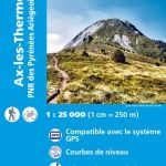
Ax-les-Thermes – PNR des Pyrenees-Ariegeoises IGN 2148ET
Topographic survey of France at 1:25,000 in IGN`s excellent TOP25 / Sรฉrie Bleue series. All the maps are GPS compatible, with a 1km UTM grid plus Read More » -

Alto Frignano – Appennino Modenese Edizioni Multigraphic 17
Alto Frignano – Appennino Modenese, map no. 17, in a series of walking maps covering the Ligurian Alps and the coast, the crest of the Apennines Read More » -

Quantock Hills & Bridgwater OS Explorer Active Map 140 (waterproof)
Quantock Hills & Bridgwater area on a detailed topographic and GPS compatible map No. 140, waterproof version, from the Ordnance Survey’s 1:25,000 Explorer series.MOBILE DOWNLOADS: this Read More » -

Limbazi District – Aloja – Krimulda – Salacgriva District Jana Seta Map
-

South Ealing 1913 – 70.3
-
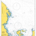
Admiralty Chart 2274 – Approaches to Kandalakshskiy Zaliv and Onezhskiy Zaliv
Admiralty standard nautical charts comply with Safety of Life at Sea (SOLAS) regulations and are ideal for professional, commercial and recreational use. Charts within the series Read More »
-


