Disclosure : This site contains affiliate links to products. We may receive a commission for purchases made through these links.
Disclosure : This site contains affiliate links to products. We may receive a commission for purchases made through these links.
Categories
-
Best Sellers
-

Exploring the Fife Coastal Path: A Companion Guide
This is the ideal guide to the whole route, so rich in history and natural beauty. Designed to be used by walkers on the Path or Read More » -
Benavente CNIG Topo 270
-
Villarcayo CNIG Topo 109-2
-

Waters of the World
How is the weather where you are? And how did it get that way? How does the great complex global interaction of ice, ocean, and atmosphere Read More » -

Insight Guides Myanmar (Burma)
From deciding when to go, to choosing what to see when you arrive, this is all you need to plan your trip and experience the best Read More » -

Perivale 1894
Perivale in 1894 in a fascinating series of reproductions of old Ordnance Survey plans in the Alan Godfrey Editions, ideal for anyone interested in the history Read More » -

Huelva CNIG Topo 999-2
Topographic coverage of mainland Spain at 1:25,000 published by the Centro Nacional de Informaciรณn Geograficรก, the country’s civilian survey organization. The maps have contours at 10m Read More » -

Stanford`s Pacific-centred World Map (1884) – A2 Wall Map, Paper
The Stanford’s Pacific-centred World Map is from a fascinating series of reproductions from our Edward Stanford Cartographic Collection archive.Originally published in 1884, this political wall map Read More » -
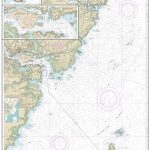
NOAA Chart 13283 – Portsmouth Harbor’”Cape Neddick Harbor to Isles of Shoals – Portsmouth Harbor
NOAA maintains the nautical charts and publications for U.S. coasts and the Great Lakes. Over a thousand charts cover 95,000 miles of shoreline and 3.4 million Read More » -

Le Cล“ur du Var ร pied
-


