Disclosure : This site contains affiliate links to products. We may receive a commission for purchases made through these links.
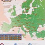
Admiralty Chart Folio 96 – East Coast of South America – Punta Piedras to Puerto Gallegos incl. Falkland Islands, South Georgia

Related Products:
 Admiralty Chart Folio 95 – East Coast of South America Cabo de Norte to Buenos Aires incl. the River, Uruguay and Parana
Admiralty Chart Folio 36 – East Coast of Africa – Delagoa Bay to Ras Hajun incl. Comoro and Seychelled Islands
Admiralty Chart Folio 72 – New Zealand ‘“ South Island, South of Cook Strait incl. Macquaire and other off-lying islands
Admiralty Chart Folio 95 – East Coast of South America Cabo de Norte to Buenos Aires incl. the River, Uruguay and Parana
Admiralty Chart Folio 36 – East Coast of Africa – Delagoa Bay to Ras Hajun incl. Comoro and Seychelled Islands
Admiralty Chart Folio 72 – New Zealand ‘“ South Island, South of Cook Strait incl. Macquaire and other off-lying islands
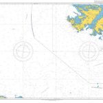
 Admiralty Chart 4207 – Falkland Islands to Cabo Corrientes and South Georgia Rise
Admiralty Chart Folio 1 – South Coast of England, The Downs to Lands End incl. Scilly Isles
Admiralty Chart Folio 6 – North and South Coasts of Scotland From Lewis to Firth of Forth incl. Orkney and Shetland Islands
Admiralty Chart Folio 20 – Northwest Coast of Africa – Strait of Gibraltar to Sierra Leone incl. Madeira, Canary, and Cape Verde Islands
Admiralty Chart Folio 98 – West Coast of South America – Chonos Archipelago to Buenaventura
Admiralty Chart Folio 43 – East Coast of India – Bangladesh, Burma and Andaman Islands
Admiralty Chart 4207 – Falkland Islands to Cabo Corrientes and South Georgia Rise
Admiralty Chart Folio 1 – South Coast of England, The Downs to Lands End incl. Scilly Isles
Admiralty Chart Folio 6 – North and South Coasts of Scotland From Lewis to Firth of Forth incl. Orkney and Shetland Islands
Admiralty Chart Folio 20 – Northwest Coast of Africa – Strait of Gibraltar to Sierra Leone incl. Madeira, Canary, and Cape Verde Islands
Admiralty Chart Folio 98 – West Coast of South America – Chonos Archipelago to Buenaventura
Admiralty Chart Folio 43 – East Coast of India – Bangladesh, Burma and Andaman Islands
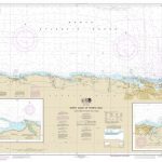 NOAA Chart 25668 – North Coast of Puerto Rico’”Punta Peรฑon to Punta Vacia Talega – Puerto Arecibo – Puerto Palmas Altas
Admiralty Chart Folio 59 – South and East Coasts of Borneo and West Coast of Sulawesi
Admiralty Chart Folio 74 – Northeast Pacific Ocean incl. Hawaiian Islands
NOAA Chart 25668 – North Coast of Puerto Rico’”Punta Peรฑon to Punta Vacia Talega – Puerto Arecibo – Puerto Palmas Altas
Admiralty Chart Folio 59 – South and East Coasts of Borneo and West Coast of Sulawesi
Admiralty Chart Folio 74 – Northeast Pacific Ocean incl. Hawaiian Islands
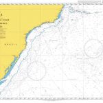
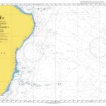 Admiralty Chart 4202 – East Coast of South America
 Admiralty Chart 4216 – North East Coast of South America
Admiralty Chart Folio 71 – New Zealand ‘“ North Island and Cook Strait Incl. Kermadec and Chatham Islands
Admiralty Chart 4216 – North East Coast of South America
Admiralty Chart Folio 71 – New Zealand ‘“ North Island and Cook Strait Incl. Kermadec and Chatham Islands
 Admiralty Chart 539 – Puerto Santa Cruz to Cabo Pilar including the Falkland Islands
Admiralty Chart Folio 66 – Sydney to Torres Strait, incl. Off-Lying reefs, Norfolk and Lord Howe Islands
Admiralty Chart Folio 5 – West Coast of Scotland From Mull to Kintyre to Loch Broom incl. part of the Hebrides
Admiralty Chart 539 – Puerto Santa Cruz to Cabo Pilar including the Falkland Islands
Admiralty Chart Folio 66 – Sydney to Torres Strait, incl. Off-Lying reefs, Norfolk and Lord Howe Islands
Admiralty Chart Folio 5 – West Coast of Scotland From Mull to Kintyre to Loch Broom incl. part of the Hebrides
 Admiralty Chart 3200 – Falkland Islands to South Sandwich Islands and Graham Land
 Admiralty Chart 3984 – South America – East Coast Capao da Marca de Fora to Cabo Polonio
Admiralty Chart Folio 25 – Mediterranean Coasts of Spain and France, Strait of Gibraltar to San Remo, incl. Balearic Islands, Corsica and Sardinia
Admiralty Chart 3984 – South America – East Coast Capao da Marca de Fora to Cabo Polonio
Admiralty Chart Folio 25 – Mediterranean Coasts of Spain and France, Strait of Gibraltar to San Remo, incl. Balearic Islands, Corsica and Sardinia
 Birds of Chile – Including the Antarctic Peninsula, the Falkland Islands and South Georgia
 Admiralty Chart 2519 – South-Western Approaches to the Falkland Islands
 Admiralty Chart 2520 – South-Eastern Approaches to the Falkland Islands
Admiralty Chart Folio 16 – North Coast of France and the Channel Islands
Admiralty Chart Folio 81 – East Coast of the United States
Admiralty Chart Folio 89 – West Coast of Central America and the United States – Mariato Point to Cape Mendocino
Admiralty Chart 2520 – South-Eastern Approaches to the Falkland Islands
Admiralty Chart Folio 16 – North Coast of France and the Channel Islands
Admiralty Chart Folio 81 – East Coast of the United States
Admiralty Chart Folio 89 – West Coast of Central America and the United States – Mariato Point to Cape Mendocino
 NOAA Chart 25677 – South Coast of Puerto Rico’”Guanica Light to Punta Tuna Light – Las Mareas
Admiralty Chart Folio 2 – Bristol Channel and South Coast of Ireland
Admiralty Chart Folio 90 – West Coast North America – Cape Mendocino to Vancouver Island including West Coast of Vancouver Island
Admiralty Chart Folio 7 – North Sea incl. Firth of Forth the Thames Entrance
NOAA Chart 25677 – South Coast of Puerto Rico’”Guanica Light to Punta Tuna Light – Las Mareas
Admiralty Chart Folio 2 – Bristol Channel and South Coast of Ireland
Admiralty Chart Folio 90 – West Coast North America – Cape Mendocino to Vancouver Island including West Coast of Vancouver Island
Admiralty Chart Folio 7 – North Sea incl. Firth of Forth the Thames Entrance
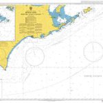
 Admiralty Chart 4201 – Southeast Coast of South America
Admiralty Chart Folio 19 – Eastern North Atlantic Ocean incl. the Azores
Admiralty Chart Folio 82 – Western North Atlantic Ocean incl. Bermuda
Admiralty Chart Folio 30 – Eastern Mediterranean ‘“ Rhodes to El Arish incl. Cyprus
Admiralty Chart 3922 – East Coast of Halmahera and the Adjacent Islands
Admiralty Chart 4201 – Southeast Coast of South America
Admiralty Chart Folio 19 – Eastern North Atlantic Ocean incl. the Azores
Admiralty Chart Folio 82 – Western North Atlantic Ocean incl. Bermuda
Admiralty Chart Folio 30 – Eastern Mediterranean ‘“ Rhodes to El Arish incl. Cyprus
Admiralty Chart 3922 – East Coast of Halmahera and the Adjacent Islands
 Admiralty Chart 1803 – Hokkaido South East Coast
 Admiralty Chart 1827 – Harbours on the South-East Coast of England
Admiralty Chart Folio 26 – West Coast of Italy – Toulon to Messina Strait and North Coast of Sicily
Admiralty Chart Folio 17 – West Coast of France and North Coast of Spain, Chaussee de Sein to Golfo de Foz
Admiralty Chart 1827 – Harbours on the South-East Coast of England
Admiralty Chart Folio 26 – West Coast of Italy – Toulon to Messina Strait and North Coast of Sicily
Admiralty Chart Folio 17 – West Coast of France and North Coast of Spain, Chaussee de Sein to Golfo de Foz