Disclosure : This site contains affiliate links to products. We may receive a commission for purchases made through these links.
Admiralty Chart Folio 89 – West Coast of Central America and the United States – Mariato Point to Cape Mendocino
Related Products:
 Admiralty Chart Folio 90 – West Coast North America – Cape Mendocino to Vancouver Island including West Coast of Vancouver Island
 Admiralty Chart Folio 81 – East Coast of the United States
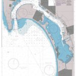 Admiralty Chart 897 – United States West Coast, California, San Diego Bay
 Admiralty Chart Folio 98 – West Coast of South America – Chonos Archipelago to Buenaventura
 NP8 Pacific Coasts of Central America and United States Pilot
 NP8 Pacific Coasts of Central America and United States Pilot – Digital
 Admiralty Chart Folio 26 – West Coast of Italy – Toulon to Messina Strait and North Coast of Sicily
 Admiralty Chart Folio 17 – West Coast of France and North Coast of Spain, Chaussee de Sein to Golfo de Foz
 Admiralty Chart Folio 13 – West Coast of Norway
 Admiralty Chart Folio 63 – Northwest Coast of Australia Gulf of Carpentaria to Cape Cuvier
 Admiralty Chart Folio 27 – Adriatic and West Coast of Greece
 Admiralty Chart Folio 41 – Pakistan and West Coast of India
 Admiralty Chart Folio 64 – Southwest Coast of Australia – Cape Cuvier to Great Australian Bight
 Admiralty Chart Folio 18 – West Coast of Spain, Portugal, Strait of Gibraltar
 Admiralty Chart Folio 4 – West Coast of Ireland from Kenmare River to Bloody Foreland
 Admiralty Chart Folio 59 – South and East Coasts of Borneo and West Coast of Sulawesi
 Admiralty Chart Folio 95 – East Coast of South America Cabo de Norte to Buenos Aires incl. the River, Uruguay and Parana
 Admiralty Chart 2417 – Harbours on the North Coast of Central America
 Admiralty Chart Folio 20 – Northwest Coast of Africa – Strait of Gibraltar to Sierra Leone incl. Madeira, Canary, and Cape Verde Islands
 Admiralty Chart Folio 5 – West Coast of Scotland From Mull to Kintyre to Loch Broom incl. part of the Hebrides
 Admiralty Chart Folio 96 – East Coast of South America – Punta Piedras to Puerto Gallegos incl. Falkland Islands, South Georgia
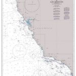 Admiralty Chart 2530 – San Diego Bay to Cape Mendocino
 Admiralty Chart 4915 – Point Arena to Cape Mendocino
 United States of America
 Central & Western United States Global Graphics Road Map
 Admiralty Chart 4802 – United States and Mexico
 USA – the Essential Geography of the United States of America
 United States of America General Map c.1900
 The Penguin History of the United States of America
 Central United States c.1900
 Stanford`s Folio Smaller Railway Map of the United States (1876) – A3 Wall Map, Canvas
 Stanford`s Folio Smaller Railway Map of the United States (1876) – A1 Wall Map, Paper
 Stanford`s Folio Smaller Railway Map of the United States (1876) – A1 Wall Map, Canvas
 ADMIRALTY Leisure Folio SC 5623 – Ireland South West Coast
 Flag of United States of America (Stars and Stripes)
 The Constitution of the United States of America with the Declaration of Independence
 Central United States Rand McNally
 NP69 East Coast of the United States Pilot Vol 2 SUPERCEDED
 Handbook of the United States of America, 1880: A Guide to Emigration
 Flag of United States of America (Stars and Stripes) – Small


