Disclosure : This site contains affiliate links to products. We may receive a commission for purchases made through these links.
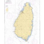
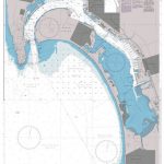
Admiralty Chart Folio 81 – East Coast of the United States

Related Products:
 Admiralty Chart Folio 89 – West Coast of Central America and the United States – Mariato Point to Cape Mendocino
 Admiralty Chart 897 – United States West Coast, California, San Diego Bay
NP69 East Coast of the United States Pilot Vol 2 SUPERCEDED
Admiralty Chart 897 – United States West Coast, California, San Diego Bay
NP69 East Coast of the United States Pilot Vol 2 SUPERCEDED
 NP68 East Coast of the United States Pilot Vol 1 SUPERCEDED
NP69 East Coast of the United States Pilot Vol 2 – 2021
NP68 East Coast of the United States Pilot Vol 1 SUPERCEDED
NP69 East Coast of the United States Pilot Vol 2 – 2021
 NP68 East Coast of the United States Pilot Vol 1 – Edition 2021
 NP68 East Coast of the United States Pilot Volume 1 – Digital
NP69 East Coast of the United States Pilot Volume 2 – Digital
Admiralty Chart Folio 59 – South and East Coasts of Borneo and West Coast of Sulawesi
Admiralty Chart Folio 43 – East Coast of India – Bangladesh, Burma and Andaman Islands
Admiralty Chart Folio 36 – East Coast of Africa – Delagoa Bay to Ras Hajun incl. Comoro and Seychelled Islands
Admiralty Chart Folio 95 – East Coast of South America Cabo de Norte to Buenos Aires incl. the River, Uruguay and Parana
Admiralty Chart Folio 96 – East Coast of South America – Punta Piedras to Puerto Gallegos incl. Falkland Islands, South Georgia
Admiralty Chart Folio 26 – West Coast of Italy – Toulon to Messina Strait and North Coast of Sicily
Admiralty Chart Folio 17 – West Coast of France and North Coast of Spain, Chaussee de Sein to Golfo de Foz
NP68 East Coast of the United States Pilot Volume 1 – Digital
NP69 East Coast of the United States Pilot Volume 2 – Digital
Admiralty Chart Folio 59 – South and East Coasts of Borneo and West Coast of Sulawesi
Admiralty Chart Folio 43 – East Coast of India – Bangladesh, Burma and Andaman Islands
Admiralty Chart Folio 36 – East Coast of Africa – Delagoa Bay to Ras Hajun incl. Comoro and Seychelled Islands
Admiralty Chart Folio 95 – East Coast of South America Cabo de Norte to Buenos Aires incl. the River, Uruguay and Parana
Admiralty Chart Folio 96 – East Coast of South America – Punta Piedras to Puerto Gallegos incl. Falkland Islands, South Georgia
Admiralty Chart Folio 26 – West Coast of Italy – Toulon to Messina Strait and North Coast of Sicily
Admiralty Chart Folio 17 – West Coast of France and North Coast of Spain, Chaussee de Sein to Golfo de Foz
 Admiralty Chart 4802 – United States and Mexico
North-East United States c.1900
Admiralty Chart 4802 – United States and Mexico
North-East United States c.1900
 Stanford`s Folio Smaller Railway Map of the United States (1876) – A3 Wall Map, Canvas
Stanford`s Folio Smaller Railway Map of the United States (1876) – A1 Wall Map, Paper
Stanford`s Folio Smaller Railway Map of the United States (1876) – A1 Wall Map, Canvas
Stanford`s Folio Smaller Railway Map of the United States (1876) – A3 Wall Map, Canvas
Stanford`s Folio Smaller Railway Map of the United States (1876) – A1 Wall Map, Paper
Stanford`s Folio Smaller Railway Map of the United States (1876) – A1 Wall Map, Canvas
 ADMIRALTY Leisure Folio SC 5601 – East Devon & Dorset Coast
 ADMIRALTY Leisure Folio SC 5614 – East Coast, Orford Ness to Whitby
Stanford`s Folio Smaller Railway Map of the United States (1876) – A3 Wall Map, Paper – Print on Demand
Stanford`s Folio Smaller Railway Map of the United States (1876) – A2 Wall Map, Paper – Print on Demand
Stanford`s Folio Smaller Railway Map of the United States (1876) – A2 Wall Map, Canvas – Print on Demand
ADMIRALTY Leisure Folio SC 5614 – East Coast, Orford Ness to Whitby
Stanford`s Folio Smaller Railway Map of the United States (1876) – A3 Wall Map, Paper – Print on Demand
Stanford`s Folio Smaller Railway Map of the United States (1876) – A2 Wall Map, Paper – Print on Demand
Stanford`s Folio Smaller Railway Map of the United States (1876) – A2 Wall Map, Canvas – Print on Demand
 ADMIRALTY Leisure Folio SC 5621 – Ireland East Coast, Carlingford Lough to Waterford
 ADMIRALTY Leisure Folio SC 5617 – East Coast, Fife Ness to Inverness and the Caledonian Canal
Admiralty Chart Folio 13 – West Coast of Norway
Admiralty Chart Folio 27 – Adriatic and West Coast of Greece
Admiralty Chart Folio 41 – Pakistan and West Coast of India
Admiralty Chart Folio 2 – Bristol Channel and South Coast of Ireland
Admiralty Chart Folio 16 – North Coast of France and the Channel Islands
Admiralty Chart Folio 3 – Irish Sea ‘“ Firth of Clyde and North Coast of Ireland
Admiralty Chart Folio 18 – West Coast of Spain, Portugal, Strait of Gibraltar
Admiralty Chart Folio 4 – West Coast of Ireland from Kenmare River to Bloody Foreland
Admiralty Chart Folio 98 – West Coast of South America – Chonos Archipelago to Buenaventura
Admiralty Chart Folio 63 – Northwest Coast of Australia Gulf of Carpentaria to Cape Cuvier
Admiralty Chart Folio 1 – South Coast of England, The Downs to Lands End incl. Scilly Isles
Admiralty Chart Folio 64 – Southwest Coast of Australia – Cape Cuvier to Great Australian Bight
Admiralty Chart Folio 65 – Southeast Coast of Australia – Tasmania from Great Australian Bight to Sydney
ADMIRALTY Leisure Folio SC 5617 – East Coast, Fife Ness to Inverness and the Caledonian Canal
Admiralty Chart Folio 13 – West Coast of Norway
Admiralty Chart Folio 27 – Adriatic and West Coast of Greece
Admiralty Chart Folio 41 – Pakistan and West Coast of India
Admiralty Chart Folio 2 – Bristol Channel and South Coast of Ireland
Admiralty Chart Folio 16 – North Coast of France and the Channel Islands
Admiralty Chart Folio 3 – Irish Sea ‘“ Firth of Clyde and North Coast of Ireland
Admiralty Chart Folio 18 – West Coast of Spain, Portugal, Strait of Gibraltar
Admiralty Chart Folio 4 – West Coast of Ireland from Kenmare River to Bloody Foreland
Admiralty Chart Folio 98 – West Coast of South America – Chonos Archipelago to Buenaventura
Admiralty Chart Folio 63 – Northwest Coast of Australia Gulf of Carpentaria to Cape Cuvier
Admiralty Chart Folio 1 – South Coast of England, The Downs to Lands End incl. Scilly Isles
Admiralty Chart Folio 64 – Southwest Coast of Australia – Cape Cuvier to Great Australian Bight
Admiralty Chart Folio 65 – Southeast Coast of Australia – Tasmania from Great Australian Bight to Sydney