Disclosure : This site contains affiliate links to products. We may receive a commission for purchases made through these links.
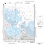
Admiralty Chart Folio 50 – Hong Kong Islands to Yangtze Kiang and Taiwan

Related Products:
 Admiralty Chart 341 – Macao to Hong Kong
 Admiralty Chart 937 – Eastern Approaches to Hong Kong
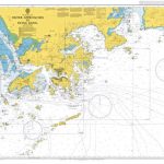
 Admiralty Chart 1962 – Hong Kong to Shantou
 Admiralty Chart 1555 – Dafangji Dao to Hong Kong
 Admiralty Chart 4122 – Hong Kong, Ma Wan and Approaches
 Admiralty Chart 3489 – Manila to Hong Kong
 Admiralty Chart 3488 – Song Sai Gon to Hong Kong
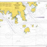
 Admiralty Chart 4121 – Hong Kong, Lamma Channels
 Admiralty Chart 3026 – Outer Approaches to Hong Kong
 Admiralty Chart 4118 – Hong Kong, Harbour – Central Part
 Admiralty Chart 4127 – Hong Kong, South Eastern Approaches
 Admiralty Chart 4129 – Hong Kong, South Western Approaches
 Admiralty Chart 4119 – Hong Kong, Harbour Western Part
 Admiralty Chart 4117 – Hong Kong Harbour – Eastern Part
 Admiralty Chart Folio 15 – Faeroes Islands, Iceland and Spitsbergen
Admiralty Chart Folio 16 – North Coast of France and the Channel Islands
Admiralty Chart Folio 86 – West Indies Islands from San Salvador and Jamaica to Antigua
Admiralty Chart Folio 70 – Fiji, Tonga, Samoa, Ellice and Gilbert Islands
Admiralty Chart Folio 74 – Northeast Pacific Ocean incl. Hawaiian Islands
Admiralty Chart Folio 56 – Korean Gulf, Siberia, Sakhalin and Kuril Islands
Admiralty Chart Folio 58 – E Sulawesi to Western New Guinea – Southeastern Part of Philippine Islands
Admiralty Chart Folio 43 – East Coast of India – Bangladesh, Burma and Andaman Islands
Admiralty Chart Folio 100 – Antarctic – Prince Edward, Crozet, Heard, McDonald & Kerguelen Islands
Admiralty Chart Folio 36 – East Coast of Africa – Delagoa Bay to Ras Hajun incl. Comoro and Seychelled Islands
Admiralty Chart Folio 71 – New Zealand ‘“ North Island and Cook Strait Incl. Kermadec and Chatham Islands
Admiralty Chart Folio 6 – North and South Coasts of Scotland From Lewis to Firth of Forth incl. Orkney and Shetland Islands
Admiralty Chart Folio 66 – Sydney to Torres Strait, incl. Off-Lying reefs, Norfolk and Lord Howe Islands
Admiralty Chart Folio 25 – Mediterranean Coasts of Spain and France, Strait of Gibraltar to San Remo, incl. Balearic Islands, Corsica and Sardinia
Admiralty Chart Folio 20 – Northwest Coast of Africa – Strait of Gibraltar to Sierra Leone incl. Madeira, Canary, and Cape Verde Islands
Admiralty Chart Folio 15 – Faeroes Islands, Iceland and Spitsbergen
Admiralty Chart Folio 16 – North Coast of France and the Channel Islands
Admiralty Chart Folio 86 – West Indies Islands from San Salvador and Jamaica to Antigua
Admiralty Chart Folio 70 – Fiji, Tonga, Samoa, Ellice and Gilbert Islands
Admiralty Chart Folio 74 – Northeast Pacific Ocean incl. Hawaiian Islands
Admiralty Chart Folio 56 – Korean Gulf, Siberia, Sakhalin and Kuril Islands
Admiralty Chart Folio 58 – E Sulawesi to Western New Guinea – Southeastern Part of Philippine Islands
Admiralty Chart Folio 43 – East Coast of India – Bangladesh, Burma and Andaman Islands
Admiralty Chart Folio 100 – Antarctic – Prince Edward, Crozet, Heard, McDonald & Kerguelen Islands
Admiralty Chart Folio 36 – East Coast of Africa – Delagoa Bay to Ras Hajun incl. Comoro and Seychelled Islands
Admiralty Chart Folio 71 – New Zealand ‘“ North Island and Cook Strait Incl. Kermadec and Chatham Islands
Admiralty Chart Folio 6 – North and South Coasts of Scotland From Lewis to Firth of Forth incl. Orkney and Shetland Islands
Admiralty Chart Folio 66 – Sydney to Torres Strait, incl. Off-Lying reefs, Norfolk and Lord Howe Islands
Admiralty Chart Folio 25 – Mediterranean Coasts of Spain and France, Strait of Gibraltar to San Remo, incl. Balearic Islands, Corsica and Sardinia
Admiralty Chart Folio 20 – Northwest Coast of Africa – Strait of Gibraltar to Sierra Leone incl. Madeira, Canary, and Cape Verde Islands
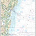
 Maritime Security Chart Q6112 – Karachi to Hong Kong
Admiralty Chart Folio 72 – New Zealand ‘“ South Island, South of Cook Strait incl. Macquaire and other off-lying islands
Admiralty Chart Folio 96 – East Coast of South America – Punta Piedras to Puerto Gallegos incl. Falkland Islands, South Georgia
Maritime Security Chart Q6112 – Karachi to Hong Kong
Admiralty Chart Folio 72 – New Zealand ‘“ South Island, South of Cook Strait incl. Macquaire and other off-lying islands
Admiralty Chart Folio 96 – East Coast of South America – Punta Piedras to Puerto Gallegos incl. Falkland Islands, South Georgia
 ADMIRALTY Leisure Folio SC 5604 – Channel Islands
 Hong Kong
 Hong Kong PopOut
 Hong Kong Noir
 Trope Hong Kong
 DK Eyewitness Top 10 Hong Kong
 Threesixfive Hong Kong
 Citix60: Hong Kong