Disclosure : This site contains affiliate links to products. We may receive a commission for purchases made through these links.
Adelaide Island and Arrowsmith Peninsula BAS
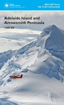
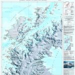
Adelaide Island and the Arrowsmith Peninsula of Antarctica at 1:250,000 on a double-sided map from the British Antarctic Survey presenting on one side contoured topographic mapping and on the reverse a stunning satellite image of the same area which includes BAS’s Rothera base.The topographic map has contours at 250m intervals with colouring for rocky outcrops, while the shading and colouring of the satellite image on the reverse has greater visual impact and provides a more vivid presentation of the terrain. Both sides include an overprint showing locations permanent and summer-only scientific stations, huts, Historic Sites and Monuments (HSMs) and Antarctic Specially Protected Areas (ASPAs). Also provided are notes about the history of exploration of this area, the Rothera Research station and local place names.The map, compiled by Magdalena Biszczuk – an ex-Stanfordian who went on to fulfil her dreams of ‘going south” one day, is part of the BAS 250P series, sheet number SQ 19-20/14 (extended), edition 1, 2010. This title is also available in a flat version.PLEASE NOTE: to see other BAS maps of wider general interest please click on the series link. A separate series on our website presents BAS titles which are of interest mainly to scientific experts or academic staff: larger scale topographic or geological/earth sciences maps of sections of the Antarctic and maps accompanied by detailed booklets/monographs.

Related Products:
 Adelaide Island And Arrowsmith Peninsula Bas Wall Map
 Brabant Island to Adelaide Island
 Northern Antarctic Peninsula
 Northern Antarctic Peninsula UKAHT Wall Map
 Antarctic Peninsula
 Antarctica and the Arctic BAS Wall Map
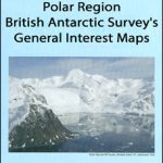
 Polar Region: British Antarctic Survey`s General Interest Maps
 Graham Land and South Shetland Islands – Scotia Sea
 Lyngen Peninsula South Nordeca 2781
 BEDMAP2 Bedrock Topography of Antarctica BAS
 Lyngen Peninsula North Nordeca 2780
 St Andrews Bay – Royal Bay, South Georgia BAS Geomorphology Wall Map
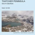 Thatcher Peninsula – South Georgia BAS
 Thatcher Peninsula – South Georgia BAS Wall Map
 BEDMAP2 Bedrock Topography of Antarctica BAS Wall Map
 James Ross Island BAS Geological Map 5
Antarctica and the Arctic BAS
James Ross Island BAS Geological Map 5
Antarctica and the Arctic BAS
 Antarctic Peninsula: A Visitor`s Guide
 Brabant Island to Adelaide Island UKAHT Wall Map
St Andrews Bay – Royal Bay, South Georgia BAS Geomorphology Map
Brabant Island to Adelaide Island UKAHT Wall Map
St Andrews Bay – Royal Bay, South Georgia BAS Geomorphology Map
 Melbourne to Adelaide – featuring the Great Ocean Road and Victorian Goldfields Hema Touring Map
 Easter Island / Rapa Nui
 Gdansk, Sopot, Gdynia and Environs – Hel Peninsula
 Adelaide Hills & Barossa SA
 Gravesend & Rochester – Hoo Peninsula OS Explorer Map 163 (paper)
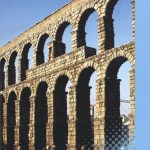 Segovia Province 200K CNIG Map No. 39
 Gravesend & Rochester – Hoo Peninsula OS Explorer Active Map 163 (waterproof)
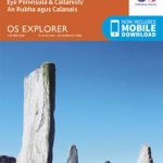 Central Lewis & Stornoway – Eye Peninsula & Callanish OS Explorer Map 459 (paper)
 Central Lewis & Stornoway – Eye Peninsula & Callanish OS Explorer Active Map 459 (waterproof)
 South Georgia BAS Geological Map 4
 Lleyn Peninsula West – Pwllheli, Abersoch & Aberdaron OS Explorer Map 253 (paper)
 Lleyn Peninsula East – Porthmadog, Criccieth & Pwllheli OS Explorer Map 254 (paper)
 Urzulei
 Adelaide and Region Hema
 Lleyn Peninsula West – Pwllheli, Abersoch & Aberdaron OS Explorer Active Map 253 (waterproof)
 Lleyn Peninsula East – Porthmadog, Criccieth & Pwllheli OS Explorer Active Map 254 (waterproof)
 Posada
Siniscola
Posada
Siniscola
 Antarctic Peninsula and Weddell Sea – Graham Land and South Shetland Islands BAS 13A/13B
 Admiralty Chart 2974 – Adelaide Island to Neny Fjord