Disclosure : This site contains affiliate links to products. We may receive a commission for purchases made through these links.
Aconcagua – Cordon del Plata
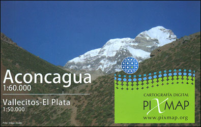
Aconcagua at 1:60,000 with on the reverse side the Cordรณn del Plata at 1:50,000 on detailed, GPS compatible map from Piximap, with trekking trails, camping sites, etc. The map provides a good picture of the region’s terrain through contours at 50m intervals enhanced by relief shading and colouring for grassland and glaciers, plus plenty of names of topographic features.On one side is the Aconcagua area extending from the peak north to Ventisquero de las Vacas glacier and south beyond the access road linking Punta de Vacas with the tunnel to Chile. Roads are classified as paved, dirt or 4×4/AWD. Trekking trails distinguish between main routes and those without waymarking. Symbols indicate locations of campsites and camping areas, ranger stations, viewpoints, waterfalls, etc. The map has latitude and longitude lines at 2’ plus UTM margin ticks. Map legend includes English.On the reverse coverage continues southwards from the same latitude of 32ยฐ54’S but at 1:50,000 and moved slightly to the east to cover an area centred on Cordรณn del Plata and the nearby Vallecitos ski resort. Presentation is as for the Aconcagua side.

Related Products:
 Aconcagua
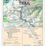
 Aconcagua and the Southern Andes: Horcones Valley (Normal) and Vacas Valley (Polish Glacier) ascent routes
 Aconcagua Climbing and Trekking Map
 Aconcagua terraQuest Trekking Map
 Argentina ACA Regional Zone 5 – Region Cuyo (incl. Aconcagua – Mendoza – San Luรญs)
 Aconcagua – Summit of South America
 War, Revolution and Society in the Rio De La Plata, 1808-1810
 Le Chemin de la Plata
 Camino Mozรกrabe (Via de la Plata): Granada to Mรฉrida
 Central Chile: Santiago – Aconcagua – Mendoza – Malargรผe ‘“ Chillรกn – Talca 500K Touring Map
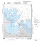
 Admiralty Chart 557 – Mar del Plata to Comodoro Rivadavia
 Admiralty Chart 1339 – Rio de La Plata and Rio Parana
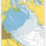 Admiralty Chart 3561 – La Plata to Nueva Palmira
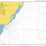
 Admiralty Chart 3329 – Mar Del Plata to Segunda Barranca
 Admiralty Chart 4200 – Rio de la Plata to Cabo de Hornos
 Torres del Paine – Puerto Natales and Environs
 John Muir Trail
 Chile`s Lake District: Pto. Varas – Ensenada – Cochamรณ
 Almaden de la Plata CNIG Topo 919
 NGA Chart 25803 – Bahia de Puerto Plata
 Volcรกn Villarrica – Lago Caburgua
 Admiralty Chart 556 – Tramandai to Mar del Plata
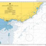 Admiralty Chart 3064 – Approaches to Rio de La Plata
 Admiralty Chart 4024 – Weddell Sea to Mar del Plata
 Admiralty Chart 3324 – Cabo San Antonio to Mar Del Plata
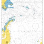
 NGA Chart 21033 – Isla del Cano to Isla la Plata
 Pokhara City – Lake Side Valley
 Kootenay National Park Gem Trek Map
 Kamnik and Savinja Alps Kartografija WATERPROOF Hiking Map
 3000 Ibones Route Editorial Alpina Trekking Map-Guide Set
 Patagonian South Icefield – Monte Fitz Roy
 Khumbu NGS Adventure Map 3002
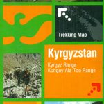 Tien Shan: Bishkek & Kyrgyz Range – Kรผngรถy Ala-Too Range 100K Gostartografiya Trekking Map
 Prince Albert NP, Saskatchewan
 Pucon – Villarrrica NP – Huerquehue NP
 Montserrat Editorial Alpina
 Argentina ACA Regional Zone 6 – Region Buenos Aires
 Paklenica National Park Croatian Mountain Rescue Service 25K Map
 Antuco – Laguna del Laja National Park