Disclosure : This site contains affiliate links to products. We may receive a commission for purchases made through these links.
Abisko – Kebnekaise – Nikkaluokta Norstedts Outdoor 1

This map of Abisko Kebnekaise Nikkaluokta in 1:75,000 is part of a series of topographic maps from Norstedts Kartforlaget which includes 28 outdoor maps covering the mountain areas and popular recreation areas in southern Sweden. The maps in this series have a new look and are printed on a durable and water resistant paper. Cartography, material and printing quality provides clear and easy to read maps ideal for hiking, canoeing and mountain tours. Each map presents an accurate topography which describes local footpaths, cycle or ski routes, sport and recreational facilities, places of interest, places to stay and eat, viewpoints.The maps have contours at 5 metre intervals, plus relief shading and graphics for rocky outcrops and boulders. Further graphics and/or colouring show different types of land use or vegetation (forests, arable land, orchards, marshes, peat bogs, etc). The maps have a 2-km UTM grid, plus latitude and longitude lines 10’ intervals. Map legend includes English.The mountain region is covered’“ from Riksgrรคnsen in the north to Sรคlen in the south ‘“ in the unique scale of 1:75 000 and adapted to hiking trails. The Kungsleden trail is specially marked with information about distance and approximate hiking time for different stages. The maps for southern Sweden cover popular recreation areas on the east- and west coast in the scale ‘“ 1:50 000.To see the list of the other titles in this series, please click on the series link.

Related Products:
 Nikkaluokta – Sarek – Saltoluokta Norstedts Outdoor 2
Jรคmtlandsfjรคllen Norstedts Outdoor 11
Nikkaluokta – Sarek – Saltoluokta Norstedts Outdoor 2
Jรคmtlandsfjรคllen Norstedts Outdoor 11
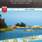 Stockholms Skargard Norstedts Outdoor 27
 Jรคkkvik – Ammarnรคs Norstedts Outdoor 5
Kvikkjokk – Jรคkkvik Norstedts Outdoor 4
Skรคckerfjรคllen – Storlien – ร…re Norstedts Outdoor 10
Jรคkkvik – Ammarnรคs Norstedts Outdoor 5
Kvikkjokk – Jรคkkvik Norstedts Outdoor 4
Skรคckerfjรคllen – Storlien – ร…re Norstedts Outdoor 10
 Tocksfors – Arjang – Nysater Norstedts Outdoor 16
Ramundberget – Funรคsdalen – Vemdalen Norstedts Outdoor 12
Rogen – Grรถvelsjรถn – Idre Norstedts Outdoor 13
Saltoluokta – Padjelanta – Kvikkjokk Norstedts Outdoor 3
Bรถrgefjell – Kittelfjรคll – Fatmomakke Norstedts Outdoor 7
Saxnรคs – Borgafjรคll – Gรคddede Norstedts Outdoor 8
Gรคddede – Hotagsfjรคllen – Fรถllinge Norstedts Outdoor 9
Fulufjรคllet – Trysil – Sรคlen Norstedts Outdoor 14
Tocksfors – Arjang – Nysater Norstedts Outdoor 16
Ramundberget – Funรคsdalen – Vemdalen Norstedts Outdoor 12
Rogen – Grรถvelsjรถn – Idre Norstedts Outdoor 13
Saltoluokta – Padjelanta – Kvikkjokk Norstedts Outdoor 3
Bรถrgefjell – Kittelfjรคll – Fatmomakke Norstedts Outdoor 7
Saxnรคs – Borgafjรคll – Gรคddede Norstedts Outdoor 8
Gรคddede – Hotagsfjรคllen – Fรถllinge Norstedts Outdoor 9
Fulufjรคllet – Trysil – Sรคlen Norstedts Outdoor 14
 Ammarnas – Hemavan – Lill-Bjorkvattnet Norstedts Outdoor 6
Ammarnรคs – Hemavan- Lill-Bjรถrkvattnet Norstedts Outdoor 6
Sweden: Norstedts 1:50,000 – 1:75,000 Topographic maps
Ammarnas – Hemavan – Lill-Bjorkvattnet Norstedts Outdoor 6
Ammarnรคs – Hemavan- Lill-Bjรถrkvattnet Norstedts Outdoor 6
Sweden: Norstedts 1:50,000 – 1:75,000 Topographic maps
 Malaren
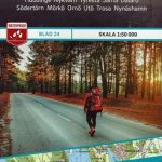 Stockholm South 24
 Charlottenberg Arvika
 Ed Amal Kopmannebro
 Marstrand – Gothenburg – Asa
 Svinesund Stromstad Hamburgsund
 Munkedal Lysekil Tjorn
 Arkosund Gryt Vastervik
 Nynashamn Oxelosund Arkosund
 Mariefred Flen Nykoping
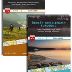
 Orskar Grisslehamn Furusund
 Abisko – Kebnekaise Kungsleden Map & Guide Set 1
 Southern Gรถtaland Norstedts Regional Map 1
 Northern Svealand – Southern Norrland Norstedts Regional Map 4
 Eastern Svealand Norstedts Regional Map 3
 Central Norrland Norstedts Regional Map 5
Western Svealand Norstedts Regional Map 2
Central Norrland Norstedts Regional Map 5
Western Svealand Norstedts Regional Map 2
 Umeรฅ
Hjo
Ed
ร…mรฅl
Laxรฅ
Nas
Umeรฅ
Hjo
Ed
ร…mรฅl
Laxรฅ
Nas