Disclosure : This site contains affiliate links to products. We may receive a commission for purchases made through these links.
South Georgia Explorer

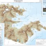
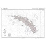
South Georgia at 1:250,000 on a tourist map showing the island’s topography, with descriptions of places of interest, plus extensive text on its history and wildlife, biographies of main explorers, a time line from 1675 to 2001, etc.The main map presents the island at 1:250,000, naming numerous peaks and glaciers, mountain ranges, bays and islets, etc. Historic sites, former whaling stations and scientific stations are marked with 22 places of special interest including wildlife breeding sites and geographical features prominently highlighted and accompanied by descriptions. Latitude and longitude lines are drawn at 20’ intervals. A small inset shows South Georgia with the South Shetland Islands, highlighting three more interesting sites.The reverse side provides an introduction to the island, notes on its history and wildlife, a time line from the first sighting of South Georgia in 1675 to 2001, biographies of ten notable explorers connected with the island including Cook, Weddell and Shackleton. Also provided is a small map showing Shackleton’s route to and across South Georgia.


