Disclosure : This site contains affiliate links to products. We may receive a commission for purchases made through these links.
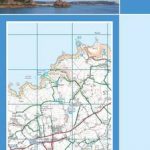
Guernsey – Alderney, Sark & Herm Official Map
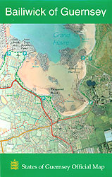
Published by the States of Guernsey (2011), this sheet is a high quality printout of the States of Guernsey Digital Map compiled by Guernsey Digimap Services. The scale is 1:15 000 or 1cm = 150m (approximately 4 ยผ inches to the mile) Grid lines are at 1km intervals and numbered in thousands of metres. Guernsey is on one side of this double-sided map, while Alderney, Sark and Herm are all on the other. Latitude and longitude are marked in red on the margins, and the UTM grid Zone 30N is in blue. The map includes tourist and leisure information such as the position of camp sites, car parks and public telephones as well as selected places of interest and antiquity. The legend includes main roads, secondary roads, minor roads, tracks and footpaths, parish boundaries and ramsar sites as well as terrain and vegetation.

Related Products:
 Guernsey – Herm – Sark – Alderney Insight Compact Guide OUT OF PRINT
 SHOM Chart 7159L – De Guernsey, Herm et Sark ร Alderney – Bancs des Casquets – Leisure A4 size
 Guernsey with Alderney, Sark and Herm Sunflower Landscape Guide
 SHOM Chart 7159 – De Guernsey, Herm et Sark ร Alderney – Bancs des Casquets
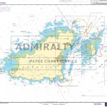 Admiralty Chart SC5604_9 – Guernsey, Herm and Sark
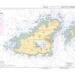
 Admiralty Chart 808 – East Guernsey – Herm and Sark
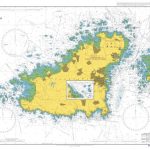
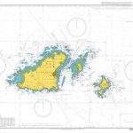 Admiralty Chart 3654 – Guernsey Herm and Sark
 SHOM Chart 6903L – Guernsey et Herm – Leisure A4 size
 SHOM Chart 6903 – Guernsey et Herm
 Admiralty Chart 807 – Guernsey and Herm
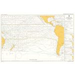
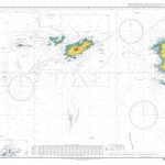 Admiralty Chart 3653 – Guernsey to Alderney and Adjacent Coast of France
 Guernsey Flexi Map
 Jersey & Guernsey ITMB
 Walking on Guernsey
 Jersey Official Leisure Map
 SHOM Chart 7160L – De Jersey ร Guernsey – Leisure A4 size
 Guernsey Beach Guide
 Berlitz Pocket Guide Guernsey
 SHOM Chart 6904 – Guernesey Est, Herm et Sark
 Guernsey Red Ensign – 1/2 yard – Printed
 Guernsey National Flag – 1/2 yard – Printed
 The Guernsey Literary and Potato Peel Pie Society
 USA Michelin
 Admiralty Chart SC5604_11 – Guernsey, Saint Peter Port – Beaucette Marina – The Casquets
 Insight Guides Great Breaks Guernsey (Travel Guide with Free eBook)
 Insight Guides Pocket Guernsey
 Admiralty Chart SC5604_4 – Guernsey to Jersey
 Admiralty Chart SC5604_10 – Guernsey, Approaches to Saint Peter Port
Highlands of Scotland Leisure and Tourist Map
Admiralty Chart SC5604_10 – Guernsey, Approaches to Saint Peter Port
Highlands of Scotland Leisure and Tourist Map
 Skye and Lochalsh Leisure and Tourist Map
 USA NGS Adventure Edition Road Atlas A3 SPIRAL-BOUND
 Yucatan ITMB
 Baltic States Reise Know-How
 Mexico Border States: Coahuila, Nuevo Leon, Tamaulipas ITMB
Brassac-les-mines – Saint-Germain-l`Herm IGN 2633SB
Costa Rica Reise Know-How
Mexico Border States: Coahuila, Nuevo Leon, Tamaulipas ITMB
Brassac-les-mines – Saint-Germain-l`Herm IGN 2633SB
Costa Rica Reise Know-How
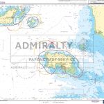
 ADMIRALTY Leisure Folio SC 5604 – Channel Islands
 Costa Rica – Panama Reise Know-How
 Milton Keynes Official City Atlas 2017
 Iceland Reise Know-How