Disclosure : This site contains affiliate links to products. We may receive a commission for purchases made through these links.
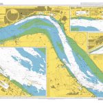
Y2 Rivers Ore and Alde
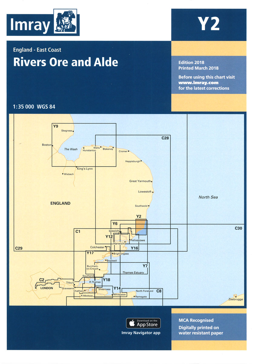
New chart which replaces old 2000.1 chart.

Related Products:
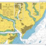
 Admiralty Chart 527 – Approaches to Demerara and Essequibo Rivers
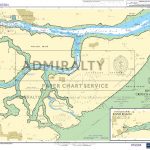
 Admiralty Chart 3741 – Rivers Colne and Blackwater
 Admiralty Chart 3750 – Rivers Crouch and Roach
 Admiralty Chart 871 – Rivers Tamar Lynher and Tavy
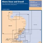
 Admiralty Chart SC5607_7 – Rivers Stour and Orwell
 Admiralty Chart 3321 – Entrances to Escravos and Forcados Rivers
 Admiralty Chart SC5607_8 – Rivers Ore and Ale – Orford Haven and Approaches
 Admiralty Chart DE20 – Entrance to the Rivers Jade and Weser
 Admiralty Chart DE2 – Approaches to Rivers Jade, Weser and Elbe
 Beyond the Two Rivers: The Continuing Story of Mannig the Heroine of Between the Two Rivers Following the Armenian Genocide
 Admiralty Chart 3455 – New York Governors Island and the Entrances to Hudson and East Rivers
 Alde Feanen – Oranjewoud – Grouw – Heerenveen ANWB Hiking Region Map
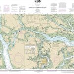
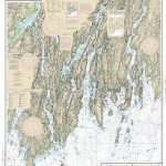
 NOAA Chart 12244 – Pamunkey and Mattaponi Rivers
 NOAA Chart 12337 – Passaic and Hackensack Rivers
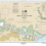 NOAA Chart 11343 – Sabine and Neches Rivers
 Admiralty Chart 2693 – Approaches to Felixstowe – Harwich and Ipswich with the Rivers Stour – Orwell and Deben
 NOAA Chart 11519 – Parts of Coosaw and Broad Rivers
 NOAA Chart 11522 – Stono and North Edisto Rivers
 NOAA Chart 14903 – Algoma to Sheboygan – Kewaunee – Two Rivers
 NOAA Chart 12282 – Chesapeake Bay’”Severn and Magothy Rivers
 Admiralty Chart SC5607_12 – Rivers Crouch and Roach – Continuation of the River Roach
 NOAA Chart 12261 – Chesapeake Bay’”Honga, Nanticoke, Wicomico Rivers & Fishing Bay
 Admiralty Chart 3497 – River Humber Immingham to Humber Bridge, Rivers Ouse and Trent
 NOAA Chart 12335 – Hudson and East Rivers’”Governors Island to 67th Street
 Y12 Rivers Stour and Orwell
 NOAA Chart 12235 – Chesapeake Bay’”Rappahannock River Entrance, Piankatank and Great Wicomico Rivers
 NOAA Chart 11329 – Houston Ship Channel – Alexander Island to Carpenters Bayou – San Jacinto and Old Rivers
 CHS Chart 3932 – Rivers Inlet
 NOAA Chart 13293 – Damariscotta, Sheepscot and Kennebec Rivers – South Bristol Harbor – Christmas Cove
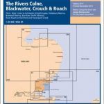 Y17 The Rivers Colne, Blackwater, Crouch and Roach
 CHS Chart 3934 – Approaches to Smith Sound and Rivers Inlet
 C14 Plymouth Harbour and Rivers
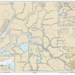 NOAA Chart 18661 – Sacramento and San Joaquin Rivers – Old River, Middle River and San Joaquin River extension – Sherman Island
 Admiralty Chart PNG378 – Daru Roads to Kerema Bay
Great Rivers of the World
Admiralty Chart PNG378 – Daru Roads to Kerema Bay
Great Rivers of the World
 Admiralty Chart 2000 – West Coast of Scotland, Gareloch
Admiralty Chart CP4 – Panama Canal Gaillard Cut
Admiralty Chart CP2 – Panama Canal North Gatun Lake
Admiralty Chart 2000 – West Coast of Scotland, Gareloch
Admiralty Chart CP4 – Panama Canal Gaillard Cut
Admiralty Chart CP2 – Panama Canal North Gatun Lake
 Admiralty Chart CP3 – Panama Canal South Gatun Lake
 Lonely Planet Cruise Ports European Rivers