Disclosure : This site contains affiliate links to products. We may receive a commission for purchases made through these links.
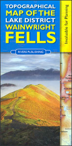
Topographical Map of the Lake District – Wainwright Fells

The fells of the Lake District shown on a contoured map at 1:100,000 approx. from Rivers Publishing, with on the reverse side tables showing the 214 fells grouped by location and each presented with its height and a column so the user can record the date climbed or other personal notes. Coverage extends from the Northern Fells group southwards to Windermere and Kendal.On one side a map at 1:100,000 approx presents the area with contours and bold altitude colouring at intervals of 50m. Each Wainwright summit is clearly marked. Road network indicates locations of car parks; also marked are campsite and caravan sites and youth hostels. The map does not have the lines of the British National Grid.On the reverse a small map indicates how the area is divided into different fell groups and tables list all the summits in each group, presenting them with heights in metres and a space for personal notes.


