Disclosure : This site contains affiliate links to products. We may receive a commission for purchases made through these links.
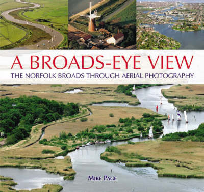
A Broads-Eye View The Norfolk Broads Through Aerial Photography

Related Products:
 England: An Aerial View
 From Above: The Story of Aerial Photography
 Norfolk Broads 1908
 Boot Up the Norfolk Broads
 Scotland`s Landscapes: The National Collection of Aerial Photography
 Norfolk Broads Canoe and Kayak Guide
 Norfolk Broads (Collins Nicholson Waterways Guides)
 Norfolk Broads Collins Nicholson Waterways Guide
 A Week on the Broads: Four Victorian Gents at Sail on a Norfolk Gaffer in 1889
 Walking in Norfolk: 40 Circular Walks in the Broads, Brecks, Fens and Along the Coast
 The Peddars Way and Norfolk Coast path: 130 mile national trail – Norfolk`s best inland and coastal scenery
 NOAA Chart 12253 – Norfolk Harbor and Elizabeth River – Norfolk Inner Harbor
 Aerial Archaeology in Britain
 The Somme Fir Tree Aerial Map
 Ireland Aerial Views
 LA NY: Aerial Photographs of Los Angeles and New York
 Ypres Salient Fir Tree Aerial Map
 The Mountains of Snowdonia Fir Tree Aerial Map
 Aerial Manoeuvres Face Covering
 The Broads Heron Maps
 Lake District National Park Aerial Map
 Broads National Park Pocket Map
 Snowdonia & North West Wales Fir Tree Aerial Map
 Egypt – A View from Above
 Roads with a View
 Norwich & The Broads – Great Yarmouth OS Landranger 134
 Greece – Ski Touring with Sea View
 The Alps – A Birds-Eye View
 Norwich & The Broads – Great Yarmouth OS Landranger 134 ACTIVE
 Time Out Norfolk
 Norfolk – Footpaths for Fitness
 The Broads – Wroxham, Beccles, Lowestoft & Great Yarmouth OS Explorer OL40
 Burke and Norfolk – Photographs from the War in Afghanistan
 The Broads – Wroxham, Beccles, Lowestoft & Great Yarmouth OS Explorer OL40 ACTIVE
 Norfolk (Slow Travel) Bradt Guide
 Insight Guides Great Breaks Norfolk & Suffolk
 Admiralty Chart 4637 – Vanuatu to Norfolk Island
 Admiralty Chart 4040 – Tuas View to Pulau Sakijang Bendera (S.John`s Island)
 Art and Photography
 Outdoor Photography


