Disclosure : This site contains affiliate links to products. We may receive a commission for purchases made through these links.
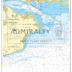
Y36 Central Solent – Laminated Chart
LAMINATED CHARTA brand new chart for 2018 covering the Central Solent. This chart is a replica of Imray chart 2200.6. It is printed on water resistant paper.

Related Products:
 Y36 Central Solent
 Y36 Central Solent SUPERCEDED
 Y32 Eastern Approach to the Solent SUPERCEDED
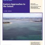
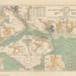
Y32 Eastern Approach to the Solent
Y32 Eastern Approach to the Solent SUPERCEDED
Y32 Eastern Approach to the Solent
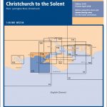
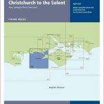 Y31 Christchurch to the Solent
 Y31 Christchurch to the Solent SUPERCEDED
Y30 Isle of Wight
Y35 Portsmouth Harbour and Approaches
Y31 Christchurch to the Solent SUPERCEDED
Y30 Isle of Wight
Y35 Portsmouth Harbour and Approaches
 Eastern approaches to the Solent – 2200.3 LAMINATED
Y34 Chichester and Langstone Harbours
Y34 Chichester and Langstone Harbours SUPERCEDED
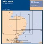
Y14 The Swale
Eastern approaches to the Solent – 2200.3 LAMINATED
Y34 Chichester and Langstone Harbours
Y34 Chichester and Langstone Harbours SUPERCEDED
Y14 The Swale
 Y14 The Swale SUPERCEDED
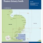 Y7 Thames Estuary South
 SHOM Chart 7647L – The Solent et Southampton Water – Leisure A4 size
 2200 Solent Chart Pack: Selsey Bill to Poole, Including the Isle of Wight – 2021 edition
Imray Chart: Laminated Isles of Scilly 2400.3
2200 Solent Chart Pack: Selsey Bill to Poole, Including the Isle of Wight – 2021 edition
Imray Chart: Laminated Isles of Scilly 2400.3
 SHOM Chart 7648L – The Solent – Approches Est – Leisure A4 size
 SHOM Chart 7646L – The Solent approches Ouest – Leisure A4 size
 Stanford`s Chart of the Solent, Spithead and Southampton Water (1932) – A3 Wall Map, Paper – Print on Demand
Stanford`s Chart of the Solent, Spithead and Southampton Water (1932) – A2 Wall Map, Paper – Print on Demand
Stanford`s Chart of the Solent, Spithead and Southampton Water (1932) – A1 Wall Map, Paper – Print on Demand
Stanford`s Chart of the Solent, Spithead and Southampton Water (1932) – A3 Wall Map, Paper – Print on Demand
Stanford`s Chart of the Solent, Spithead and Southampton Water (1932) – A2 Wall Map, Paper – Print on Demand
Stanford`s Chart of the Solent, Spithead and Southampton Water (1932) – A1 Wall Map, Paper – Print on Demand
 Y38 West Solent SUPERCEDED
Stanford`s Chart of the Solent, Spithead and Southampton Water (1932) – Original Size Wall Map, Paper – Print on Demand
Y38 West Solent SUPERCEDED
Stanford`s Chart of the Solent, Spithead and Southampton Water (1932) – Original Size Wall Map, Paper – Print on Demand
 Central Channel & the Solent
Stanford`s Chart of the Solent, Spithead and Southampton Water (1932) – A1 Wall Map, Canvas
Stanford`s Chart of the Solent, Spithead and Southampton Water (1932) – A2 Wall Map, Canvas
Central Channel & the Solent
Stanford`s Chart of the Solent, Spithead and Southampton Water (1932) – A1 Wall Map, Canvas
Stanford`s Chart of the Solent, Spithead and Southampton Water (1932) – A2 Wall Map, Canvas
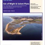 2200.9 Plans: Isle of Wight & Solent
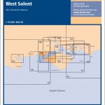
Y38 West Solent
Stanford`s Chart of the Solent, Spithead and Southampton Water (1932) – Original Size Wall Map, Canvas
SHOM Chart 7647 – The Solent et Southampton Water
Stanford`s Chart of the Solent, Spithead and Southampton Water (1932) – A3 Wall Map, Canvas – Print on Demand
2200.9 Plans: Isle of Wight & Solent
Y38 West Solent
Stanford`s Chart of the Solent, Spithead and Southampton Water (1932) – Original Size Wall Map, Canvas
SHOM Chart 7647 – The Solent et Southampton Water
Stanford`s Chart of the Solent, Spithead and Southampton Water (1932) – A3 Wall Map, Canvas – Print on Demand
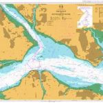 Admiralty Chart 2036 – The Solent and Southampton Water
 Christchurch to the Solent – 2200.2 SUPERCEDED
 Y41 Teignmouth and Tor Bay – Laminated chart
 Admiralty Chart SC5600_2 – Western Solent and Approaches
 Admiralty Chart SC5600_3 – Eastern Solent and Approaches
 Imray UK small-format charts: 2200 series: The Solent
SHOM Chart 7648 – The Solent – Approches Est
SHOM Chart 7646 – The Solent approches Ouest
Imray UK small-format charts: 2200 series: The Solent
SHOM Chart 7648 – The Solent – Approches Est
SHOM Chart 7646 – The Solent approches Ouest