Disclosure : This site contains affiliate links to products. We may receive a commission for purchases made through these links.
Stranton & Southern Hartlepool 1896 – 37.15

Stranton and Southern Hartlepool in 1896 in a fascinating series of reproductions of old Ordnance Survey plans in the Alan Godfrey Editions, ideal for anyone interested in the history of their neighbourhood or family. The map covers the area from Burbank Street and All Saints church southward to Foggy Furze and Longhill Farm. Various iron and steel works with their railway sidings and furnaces are major features. Other features include the Lion Brewery, Bellevue, St Aidan`s church, Hartlepools Paper Works, Baltic Saw Mills, Carr House, Longhill, etc. Street directory entries for Burbank Street, Burn Road, Lister Street, Oxford Street, Stockton Road and Stockton Street are on the reverse.About the Alan Godfrey Editions of the 25″ OS Series:Selected towns in Great Britain and Ireland are covered by maps showing the extent of urban development in the last decades of the 19th and early 20th century. The plans have been taken from the Ordnance Survey mapping and reprinted at about 15 inches to one mile (1:4,340). On the reverse most maps have historical notes and many also include extracts from contemporary directories. Most maps cover about one mile (1.6kms) north/south, one and a half miles (2.4kms) across; adjoining sheets can be combined to provide wider coverage.FOR MORE INFORMATION AND A COMPLETE LIST OF ALL AVAILABLE TITLES PLEASE CLICK ON THE SERIES LINK.

Related Products:
 Norton 1896
 West Hartlepool 1914 – 37.11c
Shildon 1896
Stockton (North) 1899 – 50.12a
Wishaw 1896
West Hartlepool 1914 – 37.11c
Shildon 1896
Stockton (North) 1899 – 50.12a
Wishaw 1896
 Hexham 1896
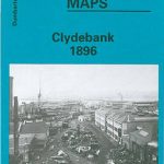 Clydebank 1896
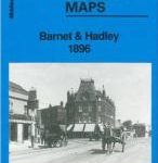 Barnet and Hadley 1896
 Watford South and New Bushey 1896
Southsea 1896 – 83.12a
Darlington North 1896
Old Portsmouth & Gosport 1896 – 83.11a
Watford South and New Bushey 1896
Southsea 1896 – 83.12a
Darlington North 1896
Old Portsmouth & Gosport 1896 – 83.11a
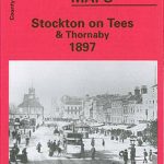 Stockton on Tees & Thornaby 1897 – 50.16a
Milngavie 1896
Drumsagard Hallside & Newton 1896 – 11.06
Lanark 1896 – 25.15
Bishop Auckland 1896 – 42.02a
Hamilton 1896
Consett 1896
Stockton on Tees & Thornaby 1897 – 50.16a
Milngavie 1896
Drumsagard Hallside & Newton 1896 – 11.06
Lanark 1896 – 25.15
Bishop Auckland 1896 – 42.02a
Hamilton 1896
Consett 1896
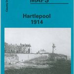 Hartlepool 1914 – 37.07c
Luton 1922 – 33.05
Jarrow 1912
Hartlepool 1914 – 37.07c
Luton 1922 – 33.05
Jarrow 1912
 New Hartley and Delaval Hall 1896
Bedford 1924 – 11.16b
New Hartley and Delaval Hall 1896
Bedford 1924 – 11.16b
 Poynton West 1896
 Croydon NW 1895 – 154
 Inverleith & Canonmills 1896 – 3.03
Kirkintilloch 1896
Bishop Middleham & Mainsforth Hall 1896 – 35.15
Broomhouse, Daldowie and Haughead 1896
Easington Lane and Bryn Gates 1896
Inverleith & Canonmills 1896 – 3.03
Kirkintilloch 1896
Bishop Middleham & Mainsforth Hall 1896 – 35.15
Broomhouse, Daldowie and Haughead 1896
Easington Lane and Bryn Gates 1896
 Derby (South) 1899 – 50.13a
Malvern Link 1926
Washington 1896
Derby (South) 1899 – 50.13a
Malvern Link 1926
Washington 1896
 Woolton 1904
Motherwell 1896
East Jarrow 1913
Trafford Park South 1937
Woolton 1904
Motherwell 1896
East Jarrow 1913
Trafford Park South 1937
 Banbridge 1903
Byker and Heaton 1913
Banbridge 1903
Byker and Heaton 1913