Disclosure : This site contains affiliate links to products. We may receive a commission for purchases made through these links.
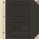
Charles Booth`s Descriptive Map of London Poverty 1889

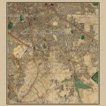
Set of four loose sheets of inner London (each measuring 52x63cm), colour-coding each street according to the relative wealth of its inhabitants in the 1880s. A fascinating look at what London life was like in this defining era.Between 1886 and 1889 a wealthy London Businessman called Charles Booth and his team of assistants conducted a research on the living and working conditions of London`s inhabitants. The project is representative of the Victorian`s concern and interest towards the urban society. Booth`s survey was thorough and accurate. Based initially on school board officials` reports, the research was then extended to local authorities` appraisals, including reports from teachers, clergy and lay helpers. Particular attention was dedicated to acquiring information on the habits of the poorer sections of society and this meant visiting numerous parts of London street-by-street, often house-by-house. Every house was marked with a seven-point colour grade, from the peachy yellow Upper-Middle and Upper Classes (described as `wealthy`) to the black Lowest Classes (`Vicious – Semi-Criminal`) – shock or amazement are left to the reader.The result was published by Williams and Norgate in 1891 in the two-volume “Labour and Life of the People”. Today the London Topographical Society is reprinting the map in a reduced format. The map is an evocative portrait of Victorian London, conjuring up the streets of deprivation as well as the green parks and wide boulevards populated by the wealthy with their coaches and shiny horses, impeccably white collars and serious, large, long skirts. A “forest of bricks bisected by a river and filled with a teeming horde of people who cherish a thousand different passions, rent by love, hunger and hate’ฆ. I mean London” (Heinrich Heine, “Travel Sketches”).


