Disclosure : This site contains affiliate links to products. We may receive a commission for purchases made through these links.
Adelaide Island and Arrowsmith Peninsula BAS
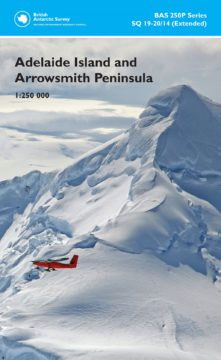
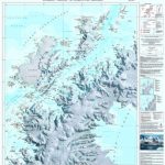
Adelaide Island and the Arrowsmith Peninsula of Antarctica at 1:250,000 on a double-sided map from the British Antarctic Survey presenting on one side contoured topographic mapping and on the reverse a stunning satellite image of the same area which includes BAS’s Rothera base.The topographic map has contours at 250m intervals with colouring for rocky outcrops, while the shading and colouring of the satellite image on the reverse has greater visual impact and provides a more vivid presentation of the terrain. Both sides include an overprint showing locations permanent and summer-only scientific stations, huts, Historic Sites and Monuments (HSMs) and Antarctic Specially Protected Areas (ASPAs). Also provided are notes about the history of exploration of this area, the Rothera Research station and local place names.The map, compiled by Magdalena Biszczuk – an ex-Stanfordian who went on to fulfil her dreams of ‘going south” one day, is part of the BAS 250P series, sheet number SQ 19-20/14 (extended), edition 1, 2010. This title is also available in a flat version.PLEASE NOTE: to see other BAS maps of wider general interest please click on the series link. A separate series on our website presents BAS titles which are of interest mainly to scientific experts or academic staff: larger scale topographic or geological/earth sciences maps of sections of the Antarctic and maps accompanied by detailed booklets/monographs.


