Disclosure : This site contains affiliate links to products. We may receive a commission for purchases made through these links.
Tipton 1904
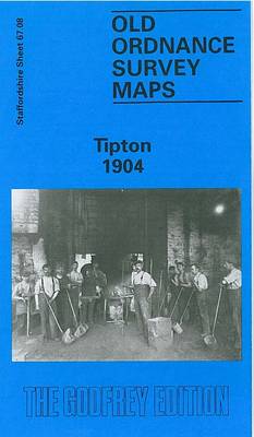
Tipton in 1904 in a fascinating series of reproductions of old Ordnance Survey plans in the Alan Godfrey Editions, ideal for anyone interested in the history of their neighbourhood or family. The map covers an industrial area in the northern part of Tipton, extending northward to Bloomfield, Tibbington, Summer Hill, Princes End,Walbrook, and westward to Foxyards Colliery. There are numerous old coal shafts and other reminders that this was once a busy coalfield. Features include LNWR Stour Valley line with Tipton station, GWR OWW line with Tipton and Princes End stations, Birmingham Canal (Wolverhampton Level), Foxyards Inn, Toll End Locks, Horseley Colliery (disused), Moat Colliery, several brick works, industrial tramways, Rounds Hill Colliery, Tipton UDC offices, Workhouse Lane Bridge, LNWR Princes End Branch with Princes End station, St John`s church, Factory Locks, several other factories (not always named), etc. About the Alan Godfrey Editions of the 25″ OS Series:Selected towns in Great Britain and Ireland are covered by maps showing the extent of urban development in the last decades of the 19th and early 20th century. The plans have been taken from the Ordnance Survey mapping and reprinted at about 15 inches to one mile (1:4,340). On the reverse most maps have historical notes and many also include extracts from contemporary directories. Most maps cover about one mile (1.6kms) north/south, one and a half miles (2.4kms) across; adjoining sheets can be combined to provide wider coverage.FOR MORE INFORMATION AND A COMPLETE LIST OF ALL AVAILABLE TITLES PLEASE CLICK ON THE SERIES LINK.

Related Products:
 Great Bridge and Toll End 1902
 Marsden 1904
Monk Bretton & Smithies 1904 – 274.04
Marsden 1904
Monk Bretton & Smithies 1904 – 274.04
 Wednesbury 1902
 Oldbury & Spon Lane 1904 – 68.14a
 Aberystwyth 1904
Royston 1904
Flixton 1904
Aberystwyth 1904
Royston 1904
Flixton 1904
 Coed-Talon 1909
 Dudley Castle 1901
Torquay 1904
Lampeter 1904
Barnsley 1904
Barnsley North East 1904
New Quay 1904
Llandovery 1904 – 18.13
Dudley Castle 1901
Torquay 1904
Lampeter 1904
Barnsley 1904
Barnsley North East 1904
New Quay 1904
Llandovery 1904 – 18.13
 Greets Green 1902
Barnsley South 1904
Trimdon Grange 1914
Newhaven & Granton 1904 – 1.15
Barnsley South East 1904
Bamfurlong and Bryn Gates 1906
Aberaeron 1904
Greets Green 1902
Barnsley South 1904
Trimdon Grange 1914
Newhaven & Granton 1904 – 1.15
Barnsley South East 1904
Bamfurlong and Bryn Gates 1906
Aberaeron 1904
 Dudley 1882 – 67.16a Coloured Edition
Paignton 1904
Dudley 1882 – 67.16a Coloured Edition
Paignton 1904
 Kidsgrove 1898
Gateacre 1904
Hamilton 1896
Kidsgrove 1898
Gateacre 1904
Hamilton 1896
 Upper Batley 1906
Brynmawr 1915 – 47.07
Boothstown and Astley Green 1904
Upper Batley 1906
Brynmawr 1915 – 47.07
Boothstown and Astley Green 1904
 Cannock South 1902
Darlaston & King`s Hill 1901
Wylde Green 1913
Cannock South 1902
Darlaston & King`s Hill 1901
Wylde Green 1913
 Poynton West 1896
Pontnewynydd 1899
Holmfirth 1904
Holytown & New Stevenston 1910 – 12.06
Poynton West 1896
Pontnewynydd 1899
Holmfirth 1904
Holytown & New Stevenston 1910 – 12.06
 Walton on the Hill 1906
Ryhope Village 1895
Walton on the Hill 1906
Ryhope Village 1895