Disclosure : This site contains affiliate links to products. We may receive a commission for purchases made through these links.
Willington Quay 1895

Willington Quay in 1895 in a fascinating series of reproductions of old Ordnance Survey plans in the Alan Godfrey Editions, ideal for anyone interested in the history of their neighbourhood or family. The map covers the area north of the Tyne and stretches to Rosehill. Features include Wallsend Cemetery, Football Ground, St Pauls Church, Willington House, both Willinton Quay Station and Howden on Tyne Station and Railway Lines; most of the map is packed with industry, showing the Shipbuilding Works, Cement Works, Wallsend Colliery, Chemical Works and Marine Engineering Works. On the reverse is an extract from a directory of 1909-10.About the Alan Godfrey Editions of the 25″ OS Series:Selected towns in Great Britain and Ireland are covered by maps showing the extent of urban development in the last decades of the 19th and early 20th century. The plans have been taken from the Ordnance Survey mapping and reprinted at about 15 inches to one mile (1:4,340). On the reverse most maps have historical notes and many also include extracts from contemporary directories. Most maps cover about one mile (1.6kms) north/south, one and a half miles (2.4kms) across; adjoining sheets can be combined to provide wider coverage.FOR MORE INFORMATION AND A COMPLETE LIST OF ALL AVAILABLE TITLES PLEASE CLICK ON THE SERIES LINK.

Related Products:
 Admiralty Chart SC5615_21 – River Tyne Royal Quays to Willington Quay – River Tyne Willington Quay to Wincomblee – River Tyne Wincomblee to Newcastle Upon Tyne
 New Quay 1904
 St Anthonys and Bill Quay 1912
Mouth of the Tyne 1895
Gateshead East 1895
Renfrew 1895
East Boldon 1895
Harton 1895
Crook West 1895
Byker and Heaton 1895
St Anthonys and Bill Quay 1912
Mouth of the Tyne 1895
Gateshead East 1895
Renfrew 1895
East Boldon 1895
Harton 1895
Crook West 1895
Byker and Heaton 1895
 Bromley North and Sundridge Park 1895
 Croydon NW 1895 – 154
Enfield (South) 1895 – 7.07a
Brightlingsea 1895
Croydon NW 1895 – 154
Enfield (South) 1895 – 7.07a
Brightlingsea 1895
 South Croydon 1895 – 14.14
 South Croydon 1895 – 159.2
 Loughton (South) 1895 – 57.16
Blackhill and Shotley Bridge 1895
Shincliffe 1895
New Eltham 1895 – 8.06
Durham City North: Framwellgate Moor 1895
Ryhope Village 1895
Loughton (South) 1895 – 57.16
Blackhill and Shotley Bridge 1895
Shincliffe 1895
New Eltham 1895 – 8.06
Durham City North: Framwellgate Moor 1895
Ryhope Village 1895
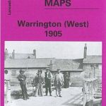 Warrington West 1905
Lanchester 1895
Central Croydon 1895 – 14.10
Guildford 1895
Chester-le-Street 1895 – 13.09a
Cullercoats and Whitley 1895
Leadgate 1895 – 11.11a
Pelton and Urpeth 1895
Warrington West 1905
Lanchester 1895
Central Croydon 1895 – 14.10
Guildford 1895
Chester-le-Street 1895 – 13.09a
Cullercoats and Whitley 1895
Leadgate 1895 – 11.11a
Pelton and Urpeth 1895
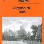 Croydon North-East 1895
 Godalming 1895
 Camberley 1895
 Croydon East: Coombe Park & Addiscombe Road 1895 – 158
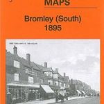 Bromley South 1895
 Bromley Common and North-East Hayes 1895
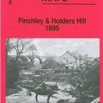 Finchley and Holders Hill 1895
 South Norwood 1895
 Croydon 1895 – 157
Low Fell 1895
Croydon 1895 – 157
Low Fell 1895