Disclosure : This site contains affiliate links to products. We may receive a commission for purchases made through these links.
Holywood 1931
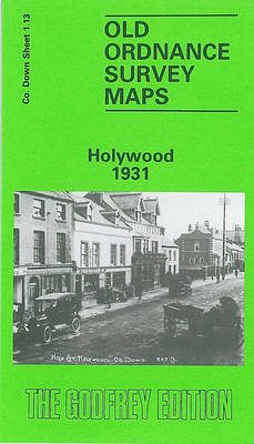
Holywood in 1931 in a fascinating series of reproductions of old Ordnance Survey plans in the Alan Godfrey Editions, ideal for anyone interested in the history of their neighbourhood or family. The map is double-sided and covers most of the town of Holywood, east of Belfast. The main map covers the area from Holywood Barracks northward to Shore Street and eastward to Ardmore Terrace. Features include railway with Holywood station and Kinnegar Halt, Holywood House, Demesne Road area, Plas Merdyn, Church Road area, town centre, Town Hall, St Phillip & St James church, St Columbkille`s RC church, Esplanade, Holywood Golf Course, etc. On the reverse is sheet 1.09, continuing coverage northward to Priory Park, Marino House, Clanbrassil Terrace and Tudor Park. About the Alan Godfrey Editions of the 25″ OS Series:Selected towns in Great Britain and Ireland are covered by maps showing the extent of urban development in the last decades of the 19th and early 20th century. The plans have been taken from the Ordnance Survey mapping and reprinted at about 15 inches to one mile (1:4,340). On the reverse most maps have historical notes and many also include extracts from contemporary directories. Most maps cover about one mile (1.6kms) north/south, one and a half miles (2.4kms) across; adjoining sheets can be combined to provide wider coverage.FOR MORE INFORMATION AND A COMPLETE LIST OF ALL AVAILABLE TITLES PLEASE CLICK ON THE SERIES LINK.

Related Products:
 Sydenham and Strandtown 1902
 Farnham 1913
Wolverhampton North West 1901
Farnham 1913
Wolverhampton North West 1901
 Furness Abbey 1931
Willesden and Stonebridge Park 1936
Furness Abbey 1931
Willesden and Stonebridge Park 1936
 Handsworth 1913
Criccieth 1913
Bridgnorth 1901
Central Croydon 1895 – 14.10
Tynemouth 1913
Southsea 1896 – 83.12a
Handsworth 1913
Criccieth 1913
Bridgnorth 1901
Central Croydon 1895 – 14.10
Tynemouth 1913
Southsea 1896 – 83.12a
 Uckfield 1908
 The Falls 1931 – 60.12
 Croydon East: Coombe Park & Addiscombe Road 1895 – 158
Bangor West 1901
Gravesend 1865
Plymouth North 1893
Bangor East 1901
Belfast Bloomfield 1902
Carlisle North-East 1924
Nottingham North 1913
Malvern Link 1926
Croydon East: Coombe Park & Addiscombe Road 1895 – 158
Bangor West 1901
Gravesend 1865
Plymouth North 1893
Bangor East 1901
Belfast Bloomfield 1902
Carlisle North-East 1924
Nottingham North 1913
Malvern Link 1926
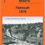 Falmouth 1878
East Barnet & Southgate 1897 – 7.09
Blackhill and Shotley Bridge 1895
Penryn 1906
Falmouth 1878
East Barnet & Southgate 1897 – 7.09
Blackhill and Shotley Bridge 1895
Penryn 1906
 Cheetham & Higher Broughton 1915 – 104.02b
Edgware 1895
Cheetham & Higher Broughton 1915 – 104.02b
Edgware 1895
 Edgware 1935
Hornsey 1894 – 12.2
Edgware 1935
Hornsey 1894 – 12.2
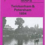 Twickenham & Petersham 1894 – 122
Southport (North) 1909 – 75.06b
Twickenham & Petersham 1894 – 122
Southport (North) 1909 – 75.06b
 St. Andrews 1893 – 9.10
Swanage 1900
Enfield (South) 1895 – 7.07a
Surbiton & Long Ditton 1912 – 12.08
St. Andrews 1893 – 9.10
Swanage 1900
Enfield (South) 1895 – 7.07a
Surbiton & Long Ditton 1912 – 12.08
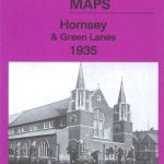 Hornsey & Green Lanes 1935 – 12.4
Tenbury 1902
Byker and Heaton 1913
Byker and Heaton 1895
Hornsey & Green Lanes 1935 – 12.4
Tenbury 1902
Byker and Heaton 1913
Byker and Heaton 1895