Disclosure : This site contains affiliate links to products. We may receive a commission for purchases made through these links.
Categories
-
Best Sellers
-

Half-full Adventure Map: San Francisco
The Half-Full Adventure Map is a new breed of map. Part map, part local guide, `Half Full-Adventure Map: San Francisco` has been designed for explorers with Read More » -

The Illustrated Compendium of Amazing Animal Facts
An artfully playful collection of unexpected and remarkable facts about animals, illustrated by Swedish artist Maja Safstrom.Did you know that an octopus has three hearts? Or Read More » -

Padua TCI Pocket Plan
Central Padua street plan on light, waterproof and tear-resistant pocket map with Touring Club Italiano’s excellent, clear cartography; indexed, with a diagram of the tram and Read More » -

Rannoch Moor & Ben Alder – Loch Rannoch OS Explorer Active Map 385 (waterproof)
Rannoch Moor, Ben Alder and Loch Rannoch area on a detailed topographic and GPS compatible map No. 385, waterproof version, from the Ordnance Survey’s 1:25,000 Explorer Read More » -
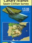
La Oliva 25K Fuerteventura CNIG Topographic Survey Map No. 1086-IV
Topographic coverage of the Canary Islands at 1:25,000 published by the Instituto Geogrรกfico Nacional ‘“ Centro Nacional de Informaciรณn Geografica, the country’s civilian survey organization. The Read More » -

SHOM Charts for the South West Coast of France – North Coast of Spain
-

Huntingdon & St Ives – Grafham Water OS Explorer Active Map 225 (waterproof)
Huntingdon, St Ives and Grafham Water area on a detailed topographic and GPS compatible map No. 225, waterproof version, from the Ordnance Survey’s 1:25,000 Explorer series. Read More » -
Mexico NGS Executive Wall Map PAPER
Mexico NGS Executive Style Wall Map from the National Geographic Society, paper version, showing the country at 1:4,370,000 with current information presented in elegant antique style Read More » -

Loch Monar, Glen Cannich & Strathfarrar OS Explorer Active Map 430 (waterproof)
Loch Monar, Glen Cannich and Glen Strathfarrar area on a detailed topographic and GPS compatible map No. 430, waterproof version, from the Ordnance Survey’s 1:25,000 Explorer Read More » -

Mecklenburg Coast and Lake District – Kiel – Hamburg – Rostock ADAC Regional Map 02
-


