Disclosure : This site contains affiliate links to products. We may receive a commission for purchases made through these links.
Europe AA Route Planner
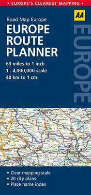
Europe on a double-sided indexed route planning map from the AA at 1:4,000,000, prominently highlighting locations worth visiting, plus 17 enlargements showing in greater detail road access to main cities. The Continent is divided so that UK and Ireland are shown on one side with northern Europe including the whole of Scandinavia; on the reverse is southern England with Europe south of the Baltic Sea. Coverage extends east to Minsk, Kiev, Rumanian and Bulgarian coat of the Black Sea, and the Aegean coastline of Turkey. In Greece and the countries using Cyrillic script all place names are in the Latin alphabet.Presentation of the road network emphasises motorways, distinguishing between free and toll routes, and gives driving distance on main routes. Railway lines are included (if not always easy to see given the number of place names) and car ferry connections are marked. The map prominently highlights names of towns worth visiting and symbols indicate other places of interest. National and natural parks are also highlighted. The map has latitude and longitude lines at 2ยบ intervals and is indexed.Surrounding panels show in greater detail road access to 17 cities: Amsterdam – Rotterdam – Utrecht area, Berlin, Bern, Brussels, Budapest, Copenhagen, Dublin, Helsinki, London, Madrid, Oslo, Paris, Prague, Rome, Stockholm, Vienna, and Warsaw. Also provided in a political map of Europe indicating for each country is area and population.


