Disclosure : This site contains affiliate links to products. We may receive a commission for purchases made through these links.
Loch Lomond & Cowal Way: with Isle of Bute
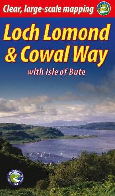
“Lavishly illustrated guidebook with route map plus practical information” – Scots MagazineThe Loch Lomond & Cowal Way runs for 57 miles (91 km) across the Cowal peninsula, which lies west of Glasgow and is easily reached by public transport, road and ferry. The route starts at Portavadie on Loch Fyne and ends at Inveruglas on Loch Lomond.The trail is waymarked and undulating, with rugged terrain and glorious views over the Isle of Bute and the Firth of Clyde. The area is rich in history and heritage, with wildlife sightings including red squirrel, red deer and golden eagle.Cowal has ferry links to Bute, to Kintyre and across Loch Lomond to join the West Highland Way. It`s the missing link that enables Scotland`s ultimate long-distance walk, from Kintyre all the way to Inverness.In November 2018 the route`s name was extended to Loch Lomond & Cowal Way to reflect the fact that over 50% of it runs within the Loch Lomond & Trossachs National Park. This new guidebook celebrates that name and contains many new photographs. However, it is a successor to the previous guidebook Cowal Way (second edition, 2016) which documented the same route.

Related Products:
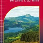 Loch Lomond & The Trossachs – Ben Lomond & Loch Katrine Harvey Superwalker XT25
 Cowal West & Isle of Bute – Rothesay OS Explorer Map 362 (paper)
 Cowal West & Isle of Bute – Rothesay OS Explorer Active Map 362 (waterproof)
 Loch Lomond & the Trossachs V1: West
 Loch Lomond, The Trossachs: 2016
 Walking Loch Lomond and the Trossachs: 70 walks, including 21 Munro summits
 Day Walks in Loch Lomond & the Trossachs: 20 routes in the southern Scottish Highlands
 Pub Walks – The Best Pub Walks in Loch Lomond & Trossachs
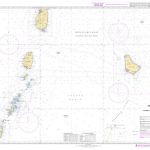
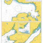
 Admiralty Chart SC5610_8 – Kyles of Bute – Caladh Harbour – Loch Riddon – Central Loch Striven – Upper Loch Striven
 Lochside Walks: The Finest Waterside Walks in Loch Lomond & the Trossachs
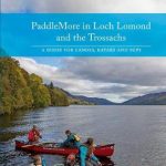 PaddleMore in Loch Lomond and The Trossachs: A Guide for Canoes, Kayaks and SUPs
 Loch Lomond National Park Collins Pocket Map
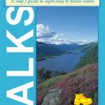
 Walks around West Loch Lomond & Clyde Sea Lochs
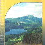
Top 10 Walks: Loch Lomond & the Trossachs
Walks around West Loch Lomond & Clyde Sea Lochs
Top 10 Walks: Loch Lomond & the Trossachs
 Walks around East Loch Lomond & Strathendrick
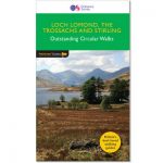
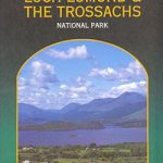
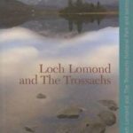 Loch Lomond and The Trossachs
 Mountain Walks – Finest Mountain Walks in Loch Lomond & Trossachs
 Rides around Loch Lomond – 5 Easy to Follow Rides
 Loch Lomond & Trossachs Mazzle – Jigsaw 1000 Pieces
 Discover the Isle of Bute
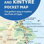 Arran, Bute and Kintyre Pocket Map – The perfect way to explore the Firth of Clyde
 Hill Walks & Easy Summits: Walks on the Lower Hills of Loch Lomond & the Trossachs
 Loch Lomond & The Trossachs Harvey Ultramap XT40
 Loch Lomond & the Trossachs National Park Outdoor Atlas
 Loch Lomond North – Tyndrum, Crianlarich & Arrochar OS Explorer Map OL39 (paper)
 Loch Lomond South – Dumbarton, Helensburgh, Drymen & Cove OS Explorer Map OL38 (paper)
 Loch Lomond North – Tyndrum, Crianlarich & Arrochar OS Explorer Active Map OL39 (waterproof)
 Loch Lomond South – Dumbarton, Helensburgh, Drymen & Cove OS Explorer Active Map OL38 (waterproof)
Admiralty Chart Folio 5 – West Coast of Scotland From Mull to Kintyre to Loch Broom incl. part of the Hebrides
Loch Lomond South – Dumbarton, Helensburgh, Drymen & Cove OS Explorer Active Map OL38 (waterproof)
Admiralty Chart Folio 5 – West Coast of Scotland From Mull to Kintyre to Loch Broom incl. part of the Hebrides
 Loch Lomond & Inveraray OS Landranger Map 56 (paper)
 Loch Lomond & Inveraray OS Landranger Active Map 56 (waterproof)
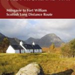 The West Highland Way: Milngavie to Fort William Scottish Long Distance Route
 Cowal East – Dunoon & Inveraray OS Explorer Map OL37 (paper)
 Cowal East – Dunoon & Inveraray OS Explorer Active Map OL37 (waterproof)
 The West Highland Way: The Official Guide
Admiralty Chart SC5610_10 – Loch Fyne – Continuation of Loch Fyne – Loch Gilp – Ardrishaig – Inveraray – Loch Gair
The West Highland Way: The Official Guide
Admiralty Chart SC5610_10 – Loch Fyne – Continuation of Loch Fyne – Loch Gilp – Ardrishaig – Inveraray – Loch Gair
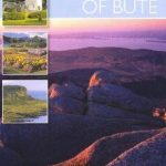 The Isle Of Bute
 Three Men on the Way Way (West Highland Way)
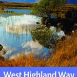 West Highland Way
 Admiralty Chart 2528 – Loch Gairloch Loch Kishorn and Loch Carron