Disclosure : This site contains affiliate links to products. We may receive a commission for purchases made through these links.
2100 Kent and Sussex Coasts Chart Atlas – 2021 edition
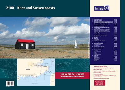
For this February 2018 edition the latest depth surveys have been applied. The latest wind farm information is included where relevant. There has been general updating throughout.The 2018 edition is now wirobound and tidal stream information is included. Individual sheets of this atlas will no longer be sold separately. However, 1st edition charts Y7 and Y14 will be published. These are replicas of charts 2100.1 and 2100.5.Chart included in the atlas are:2100.1 Thames Estuary South1: 120 000 WGS 842100.2 River Thames Sea Reach1: 50 000 WGS 842100.3 The River Thames – Queen Elizabeth Bridge to Canvey Island1: 35 000 WGS 84Plans Coalhouse Point to Canvey Island, Queen Elizabeth II Bridge to Coalhouse Point2100.4 The River Thames – Tower Bridge to Queen Elizabeth Bridge1: 35 000 WGS 84Plans Barking Creek to Queen Elizabeth II Bridge, Tower Bridge to Barking Creek2100.5 River Medway1: 40 000 WGS 84Plans Gillingham Marina, Port Werburgh, Whitton Marine, Continuation of River Medway2100.6 The Swale1: 40 000 WGS 84Plans Whitstable Harbour2100.7 North Foreland to Dover & Calais1: 115 000 WGS 842100.8 Dover to Dungeness & Cap Gris-Nez1: 115 000 WGS 842100.9 Beachy Head to Dungeness1: 115 000 WGS 84Plans Sovereign Harbour, Rye Harbour2100.10 Nab Tower to Beachy Head1: 160 000 WGS 842100.11 Kent Plans – including plan of Calais1: various WGS 84Plans Ramsgate, River Stour Entrance, Dover, Calais, Folkestone2100.12 Sussex Plans1: various WGS 84Plans Newhaven, Brighton Marina, Shoreham Harbour, Littlehampton, The Looe

Related Products:
 Imray UK small-format charts: 2100 series: Kent & Sussex Coasts
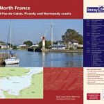 2110 North France Chart Atlas – Nord-Pas-de-Calais, Picardy and Normandy Coasts – 2017 edition
 UK4 Selsey Bill to London – 2019/20 Edition
 2300 Dorset and Devon Coasts Chart Pack – 2019 edition
 ADMIRALTY Leisure Folio SC 5606 – Thames Estuary, Ramsgate to Tower Bridge
 2000 Suffolk and Essex Chart Atlas – 2018 edition
 2600 Bristol Channel Chart Atlas – 2016 edition
 2200 Solent Chart Pack: Selsey Bill to Poole, Including the Isle of Wight – 2021 edition
 Admiralty Chart 2100 – Approaches to Bintulu Port
 2100 Greenland Eastcoast – Kap Farvel to Kap Herluf Trolle
 Admiralty Chart 1186 – River Thames – Canvey Island to Tilbury
 Admiralty Chart 3337 – River Thames Margaret Ness to Tower Bridge
 Tower Bridge: History * Engineering * Design
 Kent & Sussex
 NGA Chart 15023 – Queen Elizabeth Islands – Southern Part
 Sussex, Kent and Surrey 1939
 Imray Chart C2: The River Thames
 Tower Bridge Architectural Model Kit
 Day Walks on the High Weald: 20 circular routes in Sussex & Kent
 The Kent Ramblers Guide to the Kent Coast Path: Part 1
 Kent & East Sussex Cycle Tours
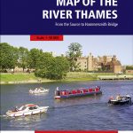 Map of the River Thames: From the Source to Hammersmith Bridge
 The Thames, A Very Peculiar History
 Rough Guide to Kent, Sussex and Surrey
 All Along the River: Tales from the Thames
 NOAA Chart 12272 – Chester River – Kent Island Narrows, Rock Hall Harbor and Swan Creek
 NGA Chart 22012 – Coasts of Peru and Chile, Pisco to Arica
 Chart Atlases for English South Coast
 Admiralty Chart SC5605_1 – Western Approaches to Dover Strait – Northern Approaches to Dover Strait
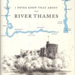 I Never Knew That About The River Thames
 2400 West Country Chart Pack – 2019 edition
 Red Bus Set of 4 Coasters
 Admiralty Chart 1185 – River Thames, Sea Reach
 Tower Bridge
NP81 Volume H: Northern & Eastern Coasts of Canada 2021
Tower Bridge
NP81 Volume H: Northern & Eastern Coasts of Canada 2021
 Waterway Guide Northern 2021 – Cape May, NJ to Eastport, ME including the Hudson River
 London Keyring – Bus
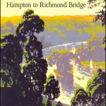 The Thames: Hampton to Richmond Walker`s Guide
 London Landmarks Set of Coasters
 London Thames Path