Disclosure : This site contains affiliate links to products. We may receive a commission for purchases made through these links.
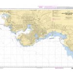
D1 Port of Spain to Cabo Codera
Waterproof navigation chart for this section of the coast of Venezuela. Includes plans of Port of Spain and Puerto Carenero.

Related Products:
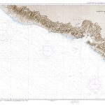
 Admiralty Chart 2191 – Morro de Puerto Santo to Cabo Codera including the Outlying Islands
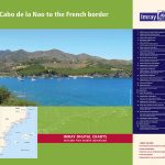 3220 Cabo de la Nao to the French border Chart Atlas – 2019 Edition
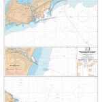
 Admiralty Chart 474 – Port of Spain and Approaches
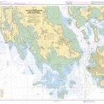
 Admiralty Chart 2192 – Cabo Codera to Punta Aguide including the Outlying Islands
 SHOM Chart 6843 – Du Cabo Creus ร Port-Barcarรจs
 Admiralty Chart 611 – Cabo Roxo to Port Kamsar
 Spain`s Sendero Historico: The GR1: Northern Spain – Picos to the Mediterranean
 SHOM Chart 6843L – Du Cabo Creus ร Port-Barcarรจs – Leisure A4 size
 Admiralty Chart 1453 – Spain – East Coast, Gandia
 Admiralty Chart 1514 – Spain – East coast, Castellon
 Admiralty Chart 1196 – Spain East Coast, Approaches to Barcelona
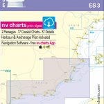 ES3 Spain, Cabo San Antonio to Gibraltar – 2018/19 Edition
 SHOM Chart 7669 – De Cabo de la Nao au port de Sagunto Isla de Ibiza et Isla de Formentera
 Admiralty Chart 666 – Port Mombasa including Port Kilindini and Port Reitz
 SHOM Chart 7669L – De Cabo de la Nao au port de Sagunto Isla de Ibiza et Isla de Formentera – Leisure A4 size
 Admiralty Chart 4742 – Harbours on the North Coast of Spain
 Admiralty Chart 4743 – Ports on the North Coast of Spain
 Admiralty Chart 1515 – Ports on the East Coast of Spain
 RCC Mediterranean Spain
 Atlantic Spain and Portugal Pilot
 SHOM Chart 7671 – De Cabo de Gata ร Cabo de Palos
 SHOM Chart 7587 – Port de Lomรฉ – Rade de Kpรฉmรฉ – Port de Cotonou
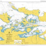
 SHOM Chart 7104 – Port de Cork – Avant Port et Approches
 SHOM Chart 5700 – Port du Pirรฉe et Baie de Phalรจre – Port Hรฉraclรฉe
 A14 San Juan to Isla de Vieques and Isla de Culebra
 NGA Chart 21026 – Puerto Madero to Cabo Velas
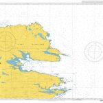
 SHOM Chart 7107 – Port de la Trinitรฉ-Sur-Mer, Port du Crouesty-Entrรฉe du Golfe du Morbihan
 SHOM Chart 7434 – Ports de Sรจte, Port-la-Nouvelle, Port-Vendres et Collioure
 Eastern Andalucia: From Malaga to Cabo de Gata, Spain: II
 Admiralty Chart 1150 – Ports on the North Coast of Spain
 Admiralty Chart 3856 – Loop Deepwater Port Louisiana Offshore Oil Port
 Admiralty Chart 8156 – Port of London Port Approach Guide
 Admiralty Chart 539 – Puerto Santa Cruz to Cabo Pilar including the Falkland Islands
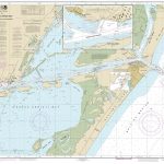 NOAA Chart 11312 – Corpus Christi Bay’”Port Aransas to Port Ingleside – Port Ingleside
 Admiralty Chart 3490 – West Coast, Port of Liverpool
Admiralty Chart Folio 17 – West Coast of France and North Coast of Spain, Chaussee de Sein to Golfo de Foz
Admiralty Chart 3490 – West Coast, Port of Liverpool
Admiralty Chart Folio 17 – West Coast of France and North Coast of Spain, Chaussee de Sein to Golfo de Foz
 Admiralty Chart 3794 – Port S Johns to Port Shepstone
 Admiralty Chart 2545 – Port Egmont to Port Purvis
 Admiralty Chart 2547 – Port Salvador to Port William
SHOM Chart 7107L – Port de la Trinitรฉ-Sur-Mer, Port du Crouesty-Entrรฉe du Golfe du Morbihan – Leisure A4 size
Admiralty Chart 2547 – Port Salvador to Port William
SHOM Chart 7107L – Port de la Trinitรฉ-Sur-Mer, Port du Crouesty-Entrรฉe du Golfe du Morbihan – Leisure A4 size