Disclosure : This site contains affiliate links to products. We may receive a commission for purchases made through these links.
Categories
-
Best Sellers
-

Colomera CNIG Topographic Map 991-III
Topographic coverage of mainland Spain at 1:25,000 published by the Centro Nacional de Informaciรณn Geograficรก, the country’s civilian survey organization. The maps have contours at 10m Read More » -

Stanford`s Folio North America Map (1884) – A2 Wall Map, Canvas
The Stanford’s Map of North America is from a fascinating series of reproductions from our Edward Stanford Cartographic Collection archive. This map was originally published in Read More » -

Cayman Islands Civil Ensign – 2yd – Sewn
We are able to source a wide range of courtesy flags. Flags are available in many sizes and can be sewn or printed on 100% Ministry Read More » -
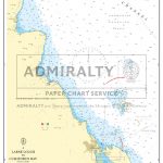
Admiralty Chart SC5612_14 – Larne Lough to Cushendun Bay
NEWAdmiralty Small Craft nautical charts comply with Safety of Life at Sea (SOLAS) regulations and are ideal for professional, commercial and recreational use. Charts within the Read More » -

Bussum
-

The Call of the Wild
Life is good for Buck in Santa Clara Valley, where he spends his days eating and sleeping in the golden sunshine. But one day a treacherous Read More » -

The Outermost House: A Year of Life on the Great Beach of Cape Cod
Henry Beston planned to spend only two weeks in his newly built cottage on the outer beach of Cape Cod. As summer drifted into autumn, however, Read More » -
Woodm CX Noel
-
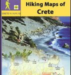
Greece: Anavasi Hiking Maps of Crete
Popular walking areas of Crete on contoured, GPS compatible maps from Anavasi at 1:25,000 โ€“ 1:35,000, printed waterproof and tear-resistant paper. Each title includes on the Read More » -

Narrowboat Nomads: Living the Dream on the English Waterways
We were aware of a dreamlike quality to our trip. There was something far-fetched about it, something out of this world. Austerity might be getting everyone Read More »
-


