Disclosure : This site contains affiliate links to products. We may receive a commission for purchases made through these links.
Categories
-
Best Sellers
-

Exploring Green Lanes & the Stories they Tell: N. & NW Devon
The green lanes of Devon have been walked by those who had to do so to earn their daily bread: from the silver mine workers of Read More » -

Katrineholm
Topographic survey of Sweden at 1:50,000, the Terrรคngkartan, from the Lantmรคteriet, covering most of the country in 244 double-sided maps. Please note: the mountainous regions of Read More » -

Summertime All The Cats Are Bored
It`s the middle of a long hot summer on the French Mediterranean shore. The town is full of tourists and at the Perpignan police headquarters, Sebag Read More » -
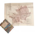
Hertfordshire 1884 Letts County Map
Hertfordshire in a series of cloth-backed reproductions from the Old Folding Maps of county maps published in late 19th century by Letts, Son & Co, with Read More » -
SHOM Chart 7772 – Golfe d`Asinara
PLEASE NOTE: the chart will be ordered for you if not currently in stock. Please allow 1-2 weeks for the chart to reach Stanfords. SHOM charts Read More » -

The Diary of Lena Mukhina: A Girl`s Life in the Siege of Leningrad
In May 1941 Lena Mukhina was an ordinary teenage girl, living in Leningrad, worrying about her homework and whether Vova – the boy she liked – Read More » -
Admiralty Chart 3221 – Lisboa, Paco de Arcos to Terreiro do Trigo
Admiralty standard nautical charts comply with Safety of Life at Sea (SOLAS) regulations and are ideal for professional, commercial and recreational use. Charts within the series Read More » -

Iceland Road Guide
Iceland Road Guide from Vegahandbรณkin, an exceptionally comprehensive, 605-page guide with region-by-region descriptions of sites accompanied by road maps and street plans, plus a separate road Read More » -

The Sentinel
1936, Badajoz: His unit defeated, his ammunition spent, a boy-soldier flees into the hills pursued by Franco`s shock-troops. He will need more than luck to survive Read More » -

NOAA Chart 16487 – Korovin Bay to Wall Bay – Martin Harbor
NOAA maintains the nautical charts and publications for U.S. coasts and the Great Lakes. Over a thousand charts cover 95,000 miles of shoreline and 3.4 million Read More »
-


