Disclosure : This site contains affiliate links to products. We may receive a commission for purchases made through these links.
Zanzibar Island

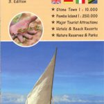
Zanzibar and the surrounding islands in the publisher’s characteristic hand-drawn style – more of a guide than just a map! Zanzibar is shown with its road network (petrol stations are marked) and vegetation, annotated with numerous places of interest, accommodation, leven banks, diving and snorkelling sites, etc.On the reverse a series of panels provide notes on everything from the island’s history and geography to marine life, Colobus monkeys, Coconut crabs, game fishing, seaweed farming, boat carpentry, witchcraft and ghosts, etc. The map is illustrated with colour photo and beautiful drawings.
Related Products:
 Zanzibar Stone Town
 Zanzibar – the Spice Island
 The Beauty of Zanzibar
 Zanzibar & Pemba Footprint Handbook
 Island Years, Island Farm
 Zanzibar Bradt Guide
 Tanzania – Zanzibar Michelin
 The Wreck of the Zanzibar
 Manabeshima Island Japan: One Island, Two Months, One Minicar, Sixty Crabs, Eighty Bites and Fifty Shots of Shochu
 The Zanzibar Chest – A Memoir of Love and War
 Central Africa & Zanzibar c.1900
 The Zanzibar Wife
 Tanzania Safari Bradt Guide: With Kilimanjaro, Zanzibar and the Coast
 Northern Tanzania: Serengeti, Kilimanjaro, Zanzibar Bradt Guide
 Admiralty Chart 3211 – Zanzibar Harbour
 Insight Guides Tanzania & Zanzibar
 Tanzania ITMB
 Zanzibar Globetrotter Travel Guide
 Landfalls – On the Edge of Islam from Zanzibar to the Alhambra
 Island on the Edge: A Life on Soay
 Kilimanjaro – Tanzania – Safari – Zanzibar
 The Last Tree on Easter Island
 NOAA Chart 16480 – Amukta Island to Igitkin Island – Seguam Island’”Finch Cove – Amlia Island’”Sviechnikof Harbor
 Admiralty Chart 2754 – Fire Island Inlet to Block Island Sound including Long Island Sound
 Brabant Island to Adelaide Island UKAHT Wall Map
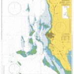 Admiralty Chart 665 – Approaches to Zanzibar
 Okinawa. The History Of An island People
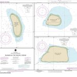 NOAA Chart 83116 – Islands in the Pacific Ocean – Baker Island – Howland Island – Jarvis Island
 NZ522 Paepae-o-Tu / Bream Tail to Kawau Island including Great Barrier Island (Aotea Island)
 CHS Chart 6416 – Saline Island to Police Island Kilometre 730-810
 Island Cross-Talk – Pages From A Blasket Island Diary
 Easter Island / Rapa Nui
 NGA Chart 61015 – Webi Jubba to Zanzibar
 To the Island of Tides: A Journey to Lindisfarne
 Manhattan: Mapping the Story of an Island
 CHS Chart 4234 – Country Island To Barren Island
 CHS Chart 7951 – Bathurst Island to Borden Island
 CHS Chart 5707 – Belanger Island to Long Island
 CHS Chart 4724 – Ticoralak Island to Carrington Island
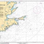 CHS Chart 4375 – Guyon Island to Flint Island


