Disclosure : This site contains affiliate links to products. We may receive a commission for purchases made through these links.
Skofjelosko – Idrijsko – Cerkljansko Hribovje
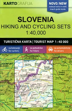
Skofjelosko – Idrijsko – Cerkljansko Hribovje region in a series of double-sided maps at 1:40,000 from Kartografija in Ljubljana, accompanied by bilingual guides with descriptions of hiking trails, cycling routes, places of interest, lists of mountain huts, etc.The maps have contours at 20m intervals, enhanced by relief shading and graphics to provide a very effective picture of the topography. Waymarked hiking trails and cycling routes are prominently highlighted and cross-referenced to their descriptions in the accompanying guides. A wide range of symbols provide information on various types of accommodation (rural hotels, motels, farms, mountain huts, campsites), recreational facilities, picturesque locations, etc. For drivers, locations of petrol stations are marked. Each map is double-sided, with a good overlap between the sides, and has latitude and longitude lines at 2’ intervals.The accompanying pocket guides are bilingual, Slovenian/English, with around 60 to 80 pages. Approximately half are descriptions of places of interest, illustrated by colour photos. Descriptions of hiking routes give timings and the degree of difficulty, as do notes for cycling routes which are also accompanied by route profiles. Also provided is a list of mountain huts.Map legends and all the text include English.

Related Products:
 Gorenjska
 Pomurje
Posocje
Ljubljana and Environs
Pomurje
Posocje
Ljubljana and Environs
 Primorska – Trieste
Slovenia: Kartografija 40K Hiking and Cycling Sets
Kamnik-Savinja Alps – Slovenian Carinthia
Primorska – Trieste
Slovenia: Kartografija 40K Hiking and Cycling Sets
Kamnik-Savinja Alps – Slovenian Carinthia
 Pohorje
 Julian Alps
 Posavsko Hribovje Kartografija Tourist Map
 Ibiza – Formentera Editorial Alpina
 Triglav Pocket Map
 Berchtesgadener Land – Bad Reichenhall – Konigssee F&B WKD5
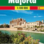
 Mallorca F&B 2-Map Set
 Montes de Malaga Map-Guide ENGLISH
 Garmisch-Partenkirchen – Wettersteingebirge – Werdenfelserland F&B WKD4
 Caps del Nord – Mallorca Editorial Alpina 2-Map Set
 Mallorca F&B
 Lake Constance F&B WKD10
 Montes de Malaga Map-Guide SPANISH
 Bled Pocket Map
 Austria: Freytag & Berndt Hiking Maps
 Landscapes along the River Ter Ed. Alpina 40K Map
 Polhograjsko Hribovje Slovenian Alpine Club 25K Map
 Vienna Woods F&B WK011
 Ljubljana and Environs Kartografija Tourist Map
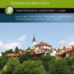 Notranjski Kras – Brkini – Dolenjska – Bela Krajina Kartografija Tourist Map
 Grossvenediger – Oberpinzgau F&B WK121
 Bregenz Forest F&B WK364
 Mallorca Central Plain – East and South Coasts Editorial Alpina
 Mรถlltal – Kreuzeckgruppe – Drautal F&B WK225
 Istria – Pula F&B Top 10 Tips
 Matrei – Deferggen – Virgental F&B WK123
 Zell am See – Kaprun – Saalbach F&B WK382
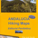
 Sierra de Grazalema Editorial Penibetica
 Semmering – Rax – Schneeberg – Schneealpe F&B WK022
 Sardinia F&B Top 10 Tips 2-Map Set
 Tennengebirge – Lammertal – Osternhorngruppe F&B WK392