Disclosure : This site contains affiliate links to products. We may receive a commission for purchases made through these links.
Lukla to Gokyo – Cho-La – Renjo-La – Nagpa-La
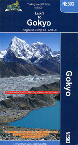
Trekking route from Lukla to Gokyo Lakes on a map at 1:55,000 from Nepa Maps. Coverage extends from Lukla to the Tibetan border from west of the Nagpa La Pass to Kala Patthar and the Old Everest Base Camp.The map shows the main routes from Lukla and Namche Bazar to the Gokyo Lakes along both sides of the Dudh Koshi Valley, with the extension to the Cho Oyu Base Camp. Also marked is the route from Namche to the lake via Thame and the Renjo Pass, the route from Thame northwards to the Nagpa La Pass, the main Everest trek from Namche to the Old Base Camp and the spur linkin it to the Gokyo routes via Cho (Chhugyuma) La Pass. Contours are at 40m intervals. Margin ticks show latitude and longitude at intervals of 2’30’’. Index lists places, peaks, lakes and passes. Additional information includes a profile of the route from Lukla to Gokyo and tables showing various trekking routes in stages with altitudes in metres and feet and trekking times.Titles in this Nepa Maps series have cartography is based on the country’s topographic survey, with contours usually at 40m or 50m intervals, enhanced by relief shading, colouring and graphics to show various features of the terrain, including glaciers, forested or cultivated areas, etc. Numerous peaks, with additional spot heights, plus names of glaciers and mountain ranges are prominently shown. The network of rivers, streams and lakes is shown in great detail, with many smaller rivers and lakes named. Overprint highlights main trekking routes and numerous local trails, with symbols indicating various places of interest and tourist facilities. Most maps are indexed and include additional information such as route profiles, glossaries, etc. All the information is in English and heights are given in metres.To see other titles in this series please click in the series link.

Related Products:
 Everest – Gokyo – Cho La – the Renjo Pass (60K)
 Everest Base Camp & Gokyo – Three Passes 50K
 Lukla to Tengboche
 Tumlingtar to Lukla
 Everest – Trekking Map & Complete Guide
 Tenzing-Hillary Trek – Jiri to Everest Base Camp
 Island Peak (Imja Tse)
 Everest: Jiri to Everest Base Camp
 Everest: A Trekker`s Guide: Base Camp, Kala Patthar and other trekking routes in Nepal and Tibet
 Solu Khumbu – Everest Region Great Himayala Trail Map
 North Annapurna Base Camp
 Mera Peak
 Cho Oyu
 Annapurna Base Camp
 Makalu Base Camp
 Lukla – Salleri
 Monastry Circuit Trail
 Kanchenjunga
 Mustang to Annapurna
 Ama Dablam
 Dhaulagiri Circuit
 Numbur Cheese Circuit
 Khumbu Himal Schneider Nepal Map 02
 Kanchenjunga Region Great Himalaya Trail Map
 Gosainkunda – Trek to Shiva`s Sacred Lake
 Everest Region Trekking Map
 Dunai to Jumla and Rara Lake
 Upper Mustang
 Upper & Lower Mustang
 Khumbu – Sagarmatha National Park
 Mustang Upper and Lower
 Ganesh Himal – Paldor Base Camp
 Naar – Phu
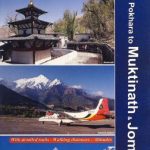 Pokhara to Muktinath and Jomosom
 Bhairab Kund
 Naya Kanga
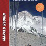 Makalu Region Great Himalay Trail Map
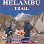 Helambu Trail
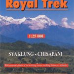 Royal Trek