Disclosure : This site contains affiliate links to products. We may receive a commission for purchases made through these links.
St-Barthรฉlemy
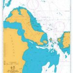
St-Barthรฉlemy at 1:10,000 from the Caribbean-based cartographer Michal Kasprowski highlighting beaches and water sports sites, with a street plan of the island`s capital. Main roads, secondary roads and unnamed tracks/footpaths are shown on the map, as are a couple of petrol stations on the small island. Symbols show beaches and water sport sites, areas where anchoring is prohibited, harbours and marinas, etc. Protected zones around the island are demarcated. Topography is indicated by map contours and spot heights, plus colouring to show woodlands. Along the coast reefs and nature reserves are marked. Latitude and longitude lines are marked at 30` intervals.A street plan of Gustavia is shown at a scale of 1:7,000. Map legend is in English.
Related Products:
 St. Martin & Anguilla ITMB
 Saint Martin / Sint Maarten
 St. Kitts and Nevis
 Anguilla
 Tahiti & Cook Islands ITMB
 St Eustatius / Statia
 Thasos Geopsis 214
 Bonaire
 Curaรงao
 Kalymnos Terrain Editions 337
 Syros Anavasi 10.22
 Sรฃo Vicente – Mindelo AB Kartenverlag Hiking Map
 Saba (Dutch Antilles)
 Ikaria Terrain Editions 332
 Senegal
 Andros Terrain Editions 307
 Aruba
Aruba
 Kythira Terrain Editions 346
 Egina / Aegina Orama Editions 338
 Folegandros Terrain Editions 316
 Nisyros Terrain Editions 339
 Hydra Terrain Editions 359
 Anafi Anavasi 10.47
 Anafi Terrain Editions 318
 Thasos Terrain Editions 323
 Santorini Terrain Editions 313
 New Zealand ITMB
 Lefkada Terrain Editions 351
 Chios Terrain Editions 328
 Patmos Terrain Editions 335
 Alonissos Terrain Editions 321
 Lemnos Terrain Editions 325
 Reunion IGN 84974
 Kythnos Terrain Editions 302
 Kos Terrain Editions Map 338
 Astypalea / Astypalaia Orama Editions 322
 Symi Terrain Editions 341
 Naxos Terrain Editions 311
 Valpelline – Saint-Barthรฉlemy L`Escursionista Editore 6
 Skopelos Terrain Editions 320


