Disclosure : This site contains affiliate links to products. We may receive a commission for purchases made through these links.
Easter Island / Rapa Nui
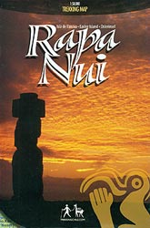
The Easter Island / Rapa Nui at 1:50,000 from Trekkingchile with on the reverse a street plan of Hanga Roa annotated with tourist accommodation and other facilities, plus notes about the island’s famous moai statues.On one side is a map of the island, with contour lines at 25m intervals drawn on a satellite imagery base enhanced with colouring to show woods, swamps, orchards and the boundaries of the Rapa Rui National Park. Local roads and paths are marked and symbols indicate various places of interest including museums and archaeological sites. Latitude and longitude are shown as margin ticks at intervals of 2`.On the reverse is a street plan of Hanga Roa, showing locations and names of hotels and restaurants, plus other tourist facilities including markets and handicraft shops, banks, car rental and petrol stations, campsite, etc. Also provided are notes on how the moai statues were carved and transports, plus colour photos of local animals.


