Disclosure : This site contains affiliate links to products. We may receive a commission for purchases made through these links.
Rila Mountains Domino
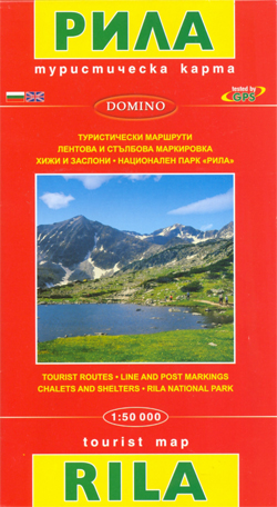
Rila Mountains at 1:50,000 on a large, double-sided, contoured map with GPS waypoints for shelters and chalets, peaks, etc. and highlighting hiking routes. Topography is shown by contours at 50m intervals with additional relief shading and graphics and colouring for scree, single rocks over 5m high, marshlands and pine scrub and forests. An overprint highlights hiking routes indicating their waymarking. Also marked are different types of tourist accommodation including campsites, mountain shelters and chalets, restaurants, drinking fountains and springs, etc. The map has latitude and longitude lines at intervals of 5’ and an additional list of GPS waypoints. Names of towns and larger villages as well as of main geographical features are in are shown in Cyrillic and Latin alphabets. Map legend includes English. Also included is a list of phone numbers of chalets and shelters.Maps in the Domino series can be used to follow local sections of the E3, E4 and E8 trans-European long-distance routes, although these routes are not specifically named on them. To see other titles in this series please click on the series link.

Related Products:
 Pirin Mountains Domino
 Samokov – Borovets with the Rila Mountains
 Western Rhodope Mountains Domino Map
 Strandzha Mountains: Burgas to the Turkish Border Domino Map
 Piatra Craiului Mountains
 Rila – Pirin terraQuest Trekking Map
 Fagaras Mountains Hiking Map and Guide
 Cindrel Mountains
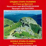 Stara Planina Central: Uzana to Vratnik Domino Map
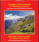 Stara Planina Western: Berkovita to Zlatitsa Domino Map
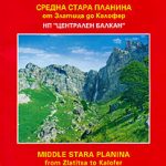 Stara Planina Central: Zlatitsa to Kalofer Domino Map
 Bulgaria: Domino Hiking Maps
 Bucegi Mountains
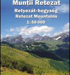
 Retezat Mountains
 Retezat Mountains Bel Alpin Tourist Map
 Bulgaria Domino DOUBLE-SIDED Road Map
 Rodnei Mountains Hiking Map and Guide
 Gurghiu Mountains Northern and Central Dimap Hiking Map
 White Mountains / Lefka Ori – Sfakia – Pahnes Anavasi 11.11/11.12
 Bihor Mountains Dimap Hiking Map
 Ciucas Mountains
 Bulgaria – City Centres Domino Road Map
 Krkonoลกe – Giant Mountains Kompass 2087
 Retezat Mountains Dimap Hiking Map
 Parang Mountains Dimap Hiking Map
Rarau-Giumalau Mountains and Bucovina Monasteries Dimap Hiking Map
Parang Mountains Dimap Hiking Map
Rarau-Giumalau Mountains and Bucovina Monasteries Dimap Hiking Map
 Western Ore Mountains – Aue – Eibenstock – Kurort Oberwiesenthal Kompass 806
 Tatra Mountains PL/SK
Tarcau Mountains and Ghimes Dimap Hiking Map
Tatra Mountains PL/SK
Tarcau Mountains and Ghimes Dimap Hiking Map
 Bergen – 7-Mountains Hike Nordeca 2429
Gilau Mountains Dimap Hiking Map
Bergen – 7-Mountains Hike Nordeca 2429
Gilau Mountains Dimap Hiking Map
 Polish and Slovak Tatra Mountains
 Radan and Sokolovica Mountains
 Mountains around Vienna Freytag & Berndt Hiking Atlas
 Cederberg Mountains Hiking Set (2-map set)
 Fagaras Mountains Dimap Hiking Map
 Karavanke Mountains – Kep to Kosuta Kartografija WATERPROOF Hiking Map
 Sredna Gora
 Crete Reise Know-How