Disclosure : This site contains affiliate links to products. We may receive a commission for purchases made through these links.
Kameลกnica Mountain Croatian Mountain Rescue Service 25K Map
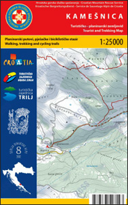
Kameลกnica Mountain and its surrounding area in the Dinaric Alps on a double-sided, contoured and GPS compatible map at 1:25,000 from the Croatian Mountain Rescue Service, with route profiles of seven recommended trails. The map covers an area on the border of southern Croatia and Bosnia-Herzegovina near the town of Sinj, not far from Split.Contours at 10m intervals enhanced by relief shading provide excellent presentation of the terrain, with markings for various topographic features; areas of ‘significant landscape” are also prominently highlighted. Waymarked hiking trails are clearly marked and road network indicates recommended cycling routes. Symbols indicate various facilities and places of interest, including mountain huts and shelters, hotels, bus station, grocery shops, petrol stations, etc. The map has a 1km UTM grid. Map legend includes English. This map is printed on demand, and if it`s out of stock it could take 3 – 4 months waiting time.To see the list of titles in this series please click on the series link.

Related Products:
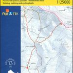
 Paklenica National Park Croatian Mountain Rescue Service 25K Map
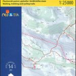
 Biokovo Mountains Croatian Mountain Rescue Service 25K Map
 Mljet Island Croatian Mountain Rescue Service 20K Map
 Istria: Cicarija Plateau Croatian Mountain Rescue Service 25K Map
 Dugi, Iลพ & Sestrunj Islands Croatian Mountain Rescue Service 25K Map
 Paลกman Island Croatian Mountain Rescue Service 25K Map
 Ugljan, Rivanj & Sestrunj Islands Croatian Mountain Rescue Service 25K Map
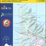 Loลกinj Island Croatian Mountain Rescue Service 25K Map
 Croatia: Mountain Rescue Service Recreational Maps
 Rab Island Croatian Mountain Rescue Service 25K Map
 Dinara
 The Mountain Hut Book
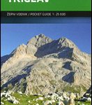 Triglav Pocket Map
 Dinara – Troglav Group West
 Dinara – Troglav Group East
 Tongariro NP: Ruapehu Round the Mountain Track
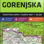 Gorenjska
 Geoparque de las Sierras Subbeticas Editorial Piolet
 Ljubljana and Environs
 Lake District Mountain Biking – Essential Trails
 Primorska – Trieste
 Beskid Maly
 Beskid Zywiecki
 Western Tatras – Polish and Slovak
 Appalachian Trail: Schaghticoke Mountain to East Mountain Hiking Atlas, CT/MA
Pomurje
Posocje
Appalachian Trail: Schaghticoke Mountain to East Mountain Hiking Atlas, CT/MA
Pomurje
Posocje
 Mallorca East Reise Know-How
 Pohorje
 Rajac Mountain
Kamnik-Savinja Alps – Slovenian Carinthia
Rajac Mountain
Kamnik-Savinja Alps – Slovenian Carinthia
 Mallorca South Reise Know-How
 Mallorca North Reise Know-How
 Mallorca West Reise Know-How
 Julian Alps
Skofjelosko – Idrijsko – Cerkljansko Hribovje
Julian Alps
Skofjelosko – Idrijsko – Cerkljansko Hribovje
 Kamnik and Savinja Alps Kartografija WATERPROOF Hiking Map
 North York Moors Mountain Biking – Moorland Trails
 Karavanke Mountains – Kep to Kosuta Kartografija WATERPROOF Hiking Map
Slovenia: Kartografija 40K Hiking and Cycling Sets
Karavanke Mountains – Kep to Kosuta Kartografija WATERPROOF Hiking Map
Slovenia: Kartografija 40K Hiking and Cycling Sets