Disclosure : This site contains affiliate links to products. We may receive a commission for purchases made through these links.
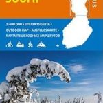
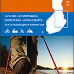
Halti – Kilpisjรคrvi Karttakeskus Outdoor Map
Halti ‘“ Kilpisjรคrvi area of northern Finland at 1:50,000 in a series of beautiful and informative maps of popular outdoor leisure areas from Karttakeskus with cartography of the country’s topographic survey. Contours are at 25m intervals, enhanced by relief shading plus graphics and/ colouring for different types of terrain and vegetation. Overprint highlights hiking routes and ski trails, as well as special nature trails, canoe routes and snowmobile routes. A wide range of symbols indicates various types of accommodation and other tourist facilities, view points, petrol stations, etc. Enlargements show in greater detail the two areas along the Kilpisjรคrvi Lake with the greatest concentration of tourist provisions.The map is fully GPS compatible with lines of three grids (Finnish KKJ, ETRS-TM35FIN and EUREF-FIN/WGS84) and also provides waypoints for several huts and rental cabins. Map legend includes English.For more titles in this series please click on the series link.

Related Products:
 Finland North Karttakeskus Outdoor Road Map
 Finland East Karttakeskus Outdoor Road Map
 Finland West Karttakeskus Outdoor Road Map
 Finland South Karttakeskus Outdoor Road Map
 Finland: Karttakeskus 250K/400K Outdoor Maps
 Lake Maggiore – Lake Orta – Lake Varese K+F Outdoor Map 8
 Lake Como K+F Outdoor Map 9
 Lake Garda – Lake Idro – Monte Baldo – Verona K+F Outdoor Map 7
 Jasper & Maligne Lake Gem Trek
 Halti
Halti
 Lake Constance West – Konstanz – Radolfzell K+F Outdoor Map 43
 Lake Constance East – Friedrichshafen – Lindau – Ravensburg – Rorschach K+F Outdoor Map 44
 Mรผritz National Park – Waren – Plauer See – Neusterlitz K+F Outdoor Map 16
 Kuusamo Karttakeskus Outdoor Map
 Repovesi – Mรคntyharju Karttakeskus Outdoor Map
 Nuuksio Luukki Karttakeskus Outdoor Map
Pyhรค – Luosto Karttakeskus Outdoor Map
Saariselkรค – Sokosti Karttakeskus Outdoor Map
Koli – Ruunaa – Patvinsuo – Petkeljรคrvi Karttakeskus Outdoor Map
Nuuksio Luukki Karttakeskus Outdoor Map
Pyhรค – Luosto Karttakeskus Outdoor Map
Saariselkรค – Sokosti Karttakeskus Outdoor Map
Koli – Ruunaa – Patvinsuo – Petkeljรคrvi Karttakeskus Outdoor Map
 Val Venosta / Vinschgau K+F Outdoor Map 1
 Bolzano – Caldaro – Wine Route – Eggental – Neumarkt – Cavalese K+F Outdoor Map 3
 Val Pusteria – Dolomiti di Sesto K+F Outdoor Map 5
 Cortina d`Ampezzo – Tre Cime di Lavaredo K+F Outdoor Map 6
Finland Karttakeskus Road Atlas
Cortina d`Ampezzo – Tre Cime di Lavaredo K+F Outdoor Map 6
Finland Karttakeskus Road Atlas
 Merano and Environs – Texel Group – Sarntal – Bolzano K+F Outdoor Map 2
 Groden – Seiseralm – Rosengarten – Sella – Marmolada K+F Outdoor Map 4
 Teutoburg Forest K+F Outdoor Map 45
 Bad Gastein K+F Outdoor Map 16
 Tegernsee – Schliersee K+F Outdoor Map 5
Starnberger See – Ammersee K+F Outdoor Map 27
Tegernsee – Schliersee K+F Outdoor Map 5
Starnberger See – Ammersee K+F Outdoor Map 27
 Pfaffenwinkel – Peissenberg – Weilheim K+F Outdoor Map 28
 Bad Tรถlz – Lenggries – Isarwinkel K+F Outdoor Map 4
 Rรผgen – Hiddensee – Stralsund K+F Outdoor 14
 Finland East Karttakeskus Road Map
 Wรถrthersee – Ossiacher See K+F Outdoor Map 17
Berchtesgaden ‘“ Bad Reichenhall ‘“ Kรถnigsee K+F Outdoor Map 8
Wรถrthersee – Ossiacher See K+F Outdoor Map 17
Berchtesgaden ‘“ Bad Reichenhall ‘“ Kรถnigsee K+F Outdoor Map 8
 Wiener Hausberge K+F Outdoor Map 21
Kempten – Allgau – Immenstadt – Bad Grรถnenbach K+F Outdoor Map 46
Wiener Hausberge K+F Outdoor Map 21
Kempten – Allgau – Immenstadt – Bad Grรถnenbach K+F Outdoor Map 46
 Vienna Woods / Wienerwald K+F Outdoor Map 20
 Weinviertel East K+F Outdoor Map 19