Disclosure : This site contains affiliate links to products. We may receive a commission for purchases made through these links.
Camps and Other Nazi Detention Places Map
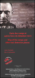
Camps and Other Nazi Detention Places map from Belgium’s national survey organization shows the territory of pre-WWII Germany plus present day Poland, Czech Republic, Austria, Netherlands, Belgium and the north-eastern corner of France. Background colouring indicates pre-Anschluss Germany in 1937, the territory of the Nazi Germany and its directly annexed areas in 1942 including the part designated as the General Government of Poland, plus other occupied or neutral countries. The map also shows present day international boundaries.Detention centres are marked by symbols graded into 14 types, from prisons and stalags or oflags to concentrations and extermination camps, with the text on the reverse of the map explaining the differences and providing other background information. All the text is in English, German, French and Dutch. The map comes with a separate index arranged by the types of the detention centres and giving present day names of locations outside Germany.The map provides an excellent if frightening picture of the cruelty of the Nazi regime. Viewed through the Polish eyes of the writer this description, it could still be improved by more accurate and stronger colouring and by better editing of place names within Poland, where either Polish or German names are used without consistency.


