Disclosure : This site contains affiliate links to products. We may receive a commission for purchases made through these links.
Categories
-
Best Sellers
-

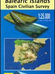
Pollenรงa – Mallorca CNIG Topo 644-4/645-3
Topographic coverage of the Balearic Islands at 1:25,000 published by the Instituto Geogrรกfico Nacional ‘“ Centro Nacional de Informaciรณn Geografica, the country’s civilian survey organization. The Read More » -

Jump!
A frog jumps. Boing! A kitten jumps. Boi-ing! A dog jumps. Boi-oi-oi-oi-oing! . . . “And I jump too–BOING!”This joyful book gets children joining in the Read More » -

Man`s Search for Meaning: The Classic Tribute to Hope from the Holocaust
A prominent Viennese psychiatrist before the war, Viktor Frankl was uniquely able to observe the way that both he and others in Auschwitz coped (or didn`t) Read More » -

Luggage Tag Pineapple
#NAME? Read More » -

Admiralty Chart 729 – Plans in the Gilbert Islands
Admiralty standard nautical charts comply with Safety of Life at Sea (SOLAS) regulations and are ideal for professional, commercial and recreational use. Charts within the series Read More » -
Alde Feanen – Oranjewoud – Grouw – Heerenveen ANWB Hiking Region Map
-

Bangkok Handy Atlas
Bangkok Handy Atlas from the Thai publishers Thinknet, in an A5 paperback format, presenting the metropolitan area at 1:71,000, central Bangkok at 1:19,000, and seven of Read More » -

The Brother Gardeners
“The Brother Gardeners” begins one January morning in 1734, when cloth merchant Peter Collinson hurried down to the docks at London`s Custom House to collect cargo Read More » -

Bookaroo Pen – Mustard
Handy little pen holder for notebooks and journals. Securely attaches to your notebook and holds your pen in style! These cute little Self-adhesive leather effect PU Read More » -

NOAA Chart 12253 – Norfolk Harbor and Elizabeth River – Norfolk Inner Harbor
NOAA maintains the nautical charts and publications for U.S. coasts and the Great Lakes. Over a thousand charts cover 95,000 miles of shoreline and 3.4 million Read More »
-


