Disclosure : This site contains affiliate links to products. We may receive a commission for purchases made through these links.
Categories
-
Best Sellers
-
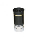
9mm UltraWide Eyepiece (1.25″/31.7mm Format)
We keep this item in our warehouse and it may take a month to reach you.These Sky-Watcher Ultra-Wide Angle, Multi-Coated, Long Eye Relief eyepieces offer a Read More » -

Italy: IGA 50K Hiking Maps of Central Italy
Central Italy on a series of contoured, GPS compatible hiking maps at 1:50,000 from the Istituto Geografico Adriatico, covering eastern Tuscany, with northern Umbria and the Read More » -

Kitchener – Waterloo Street Atlas
Street atlas of Kitchener and the surrounding area, including Ayr, Baden, Blair, Bloomingdale, Brant, Brantford, Breslau, Bridgeport, Cambridge, Conestogo, Doon, Elmira, Elora, Erin, Fergus, Galt, Guelph, Read More » -
Joensuu
The 1:50,000 topographic map gives a more general picture of the ground features than a basic map. It shows settlements, houses, roads, cultivated areas, waterways, cutting Read More » -
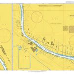
Admiralty Chart 3843 – Inner Bar to Kabda Point
Admiralty standard nautical charts comply with Safety of Life at Sea (SOLAS) regulations and are ideal for professional, commercial and recreational use. Charts within the series Read More » -

Windsor Castle: Official Souvenir
The official guide to Windsor Castle, published in conjunction with the Royal Collection Trust. A royal castle for nearly a thousand years, Windsor Castle is the Read More » -

Admiralty Chart 2650 – Huanghua Gang and Approaches
Admiralty standard nautical charts comply with Safety of Life at Sea (SOLAS) regulations and are ideal for professional, commercial and recreational use. Charts within the series Read More » -

Land`s End – Penzance & St Ives OS Explorer 102 ACTIVE
The OS Explorer Active range includes a digital version of the paper map, accessed through the OS smartphone app, OS Maps. Read More » -

Bordeaux – Sud Medoc IGN 1536OT
Topographic survey of France at 1:25,000 in IGN`s excellent TOP25 / Sรฉrie Bleue series. All the maps are GPS compatible, with a 1km UTM grid plus Read More » -

Picardy
Picardy in a series of guides from Editions Grafocarte/Editions de l`Ecluse to France’s canals and navigable waterways with mapping showing facilities and navigational hazards along each Read More »
-


