Disclosure : This site contains affiliate links to products. We may receive a commission for purchases made through these links.
Valle del Ticino – Arona – Legnano – Magenta Geo4Map 1

Related Products:
 Valle del Ticino – Abbiategrasso – Bereguardo – Pavia Geo4Map 2
Valle del Ticino – Novara – Lago d`Orta – Stresa Geo4Map 3
Valle del Ticino – Abbiategrasso – Bereguardo – Pavia Geo4Map 2
Valle del Ticino – Novara – Lago d`Orta – Stresa Geo4Map 3
 Valle Isorno – Valle Antigorgio – Val Vigezzo – Valle Maggia Geo4Map 12
 Ticino North – Valle Maggia – Leventina K+F Hiking Map 26
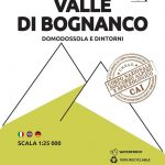 Valle di Bognanco – NP Alpe Veglia Geo4Map 8
 Valle Anzasca – Vanzone – Piedimulera Geo4Map 6
Valle Anzasca – Monte Rosa – Macugnaga Geo4Map 5
Valle Anzasca – Vanzone – Piedimulera Geo4Map 6
Valle Anzasca – Monte Rosa – Macugnaga Geo4Map 5
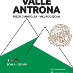 Valle Antrona – Pizzo d`Andolla – Villadossola Geo4Map 7
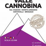 Valle Cannobina – Val Vigezzo – Monte Limidario Geo4Map 13
Alpe Devero – Val Formazza – Binntal – Valle del Goms Geo4Map 10
Valle Cannobina – Val Vigezzo – Monte Limidario Geo4Map 13
Alpe Devero – Val Formazza – Binntal – Valle del Goms Geo4Map 10
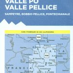 Monviso – Valle Varaita – Valle Po – Valle Pellice IGC 106
Arona 30K Zanetto Map No. 51
Alpi Orobie Bergamasche – Valle Brembana – Valle Seriana Kompass 104
Monviso – Valle Varaita – Valle Po – Valle Pellice IGC 106
Arona 30K Zanetto Map No. 51
Alpi Orobie Bergamasche – Valle Brembana – Valle Seriana Kompass 104
 Valle de Canfranc – Valle de Aisa – Candanchu – Astun Editorial Alpina
 Gran San Bernardo – Valle di Ollomont – Mont Fallรฉre – Aosta Valle Centrale Fraternali Editore 30
 Gran Paradiso – Valle d`Aosta – Valle del`Orco Kompass 86
 Val Soana – Valle di Ribordone – Valle di Locana L`Escursionista Editore 15
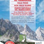 Val Vermenagna – Valle Pesio – Alta Valle Ellero
 La Valpelline – Valle di Ollomont – Valle di St. Barthelemy 30K IGC Map
 Valle Soana – Bassa Valle Orco
 Ticino Swisstopo 107
 Alta Valle del Metauro: Valle del Candigliano, Monte Nerone, Monte Catria
Chart Correcting Pen – Magenta
Ticino Hallwag Panorama Map
Alta Valle del Metauro: Valle del Candigliano, Monte Nerone, Monte Catria
Chart Correcting Pen – Magenta
Ticino Hallwag Panorama Map
 Val Maira – Val Grana – Valle Stura – Valle Gesso Fraternali Editore 50-3
Bassa Valle Varaita – Bassa Valle Maira Fraternali Editore 12
Ticino – Graubรผnden Hallwag Road Map
Alta Val Tanaro – Alta Valle Arroscia – Alta Valle Argentina
Val Maira – Val Grana – Valle Stura – Valle Gesso Fraternali Editore 50-3
Bassa Valle Varaita – Bassa Valle Maira Fraternali Editore 12
Ticino – Graubรผnden Hallwag Road Map
Alta Val Tanaro – Alta Valle Arroscia – Alta Valle Argentina
 Val Grande Geo4Map 14
Val Vigezzo Geo4Map 5
Val Grande Geo4Map 14
Val Vigezzo Geo4Map 5
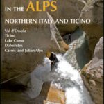 Canyoning in the Alps: Northern Italy and Ticino
 Ticino South – Lugano – Lake Maggiore K+F Hiking Map 29
Grigne Resegone – Valsassina Geo4Map 301
Ticino South – Lugano – Lake Maggiore K+F Hiking Map 29
Grigne Resegone – Valsassina Geo4Map 301
 Val Formazza – Val Bavona – Val Maggia Geo4Map 11 SUPERCEDED
Alto Verbano – Val Grande – Cannobio Geo4Map 15
Lago Maggiore – Luino – Val Veddasca Geo4Map 305
Mischabel – Saas Fee – Grรคchen – Tรคsch Geo4Map 22
Val Formazza – Val Bavona – Val Maggia Geo4Map 11 SUPERCEDED
Alto Verbano – Val Grande – Cannobio Geo4Map 15
Lago Maggiore – Luino – Val Veddasca Geo4Map 305
Mischabel – Saas Fee – Grรคchen – Tรคsch Geo4Map 22
 Valsesia – Val Mastallone – Boccioleto – Rossa – Varallo Geo4Map 3
Cinque Terre – Golfo della Spezia Geo4Map 21
Cervino / Matterhorn – Zermatt – Breuil Cervinia Geo4Map 23
Valsesia – Val Mastallone – Boccioleto – Rossa – Varallo Geo4Map 3
Cinque Terre – Golfo della Spezia Geo4Map 21
Cervino / Matterhorn – Zermatt – Breuil Cervinia Geo4Map 23