Disclosure : This site contains affiliate links to products. We may receive a commission for purchases made through these links.
Disclosure : This site contains affiliate links to products. We may receive a commission for purchases made through these links.
Categories
-
Best Sellers
-
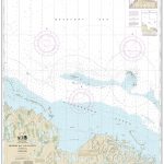
NOAA Chart 16061 – Prudhoe Bay and Vicinity
NOAA maintains the nautical charts and publications for U.S. coasts and the Great Lakes. Over a thousand charts cover 95,000 miles of shoreline and 3.4 million Read More » -

Washington DC Red Maps
Washington DC on a tourist street plan from Red Maps presented in a handy concertina format and printed on thick high quality paper, with thematic indexes Read More » -

Spain – Culture Smart!
For many, Spain conjures up images of rapacious conquistadors, the unworldly Don Quixote, brave bullfighters, fiery flamenco dancers, and brilliant artists. All true enough’”but how does Read More » -

Art and Optics in the Hereford Map: An English Mappa Mundi, c. 1300
A single, monumental mappa mundi (world map), made around 1300 for Hereford Cathedral, survives intact from the Middle Ages. As Marcia Kupfer reveals in her arresting Read More » -

Competition Bicycle
“The Competition Bicycle” will inspire cyclists and design lovers alike. The evocative, detail-rich photographs display the history of the bicycle, from racing high-wheelers to modern racing Read More » -

NGA Chart 22004 – Cabo de San Francisco to Paita
Produced by the US Government, National Geospatial-Intelligence Agency (NGA) charts provide information for the International Waters. They are printed on demand at our London shop and Read More » -

Selected Poems of Edward Thomas
When Edward Thomas was killed at the Battle of Arras in 1917 his poems were largely unpublished. But in the years since his death, his work Read More » -

Chianti
Chianti, the region between Florence and Siena, on a detailed contoured map at 1:50,000 from Litografia Artistica Cartografica, overprinted with numerous hiking routes and highlighting various Read More » -

Africa c.1880 MEDIUM
Small size cloth-backed version of a reproduction by Old Folding Maps of Edward Mogg`s ‘Stranger`s Guide to London, Exhibiting all the various Alterations & Improvements complete Read More » -

Help Your Kids with Geography, Ages 10-16 (Key Stages 3 & 4): A Unique Step-By-Step Visual Guide
Help your kids to be the best in their geography class. This book will help you to understand what they`re being taught so you can help Read More »
-


