Disclosure : This site contains affiliate links to products. We may receive a commission for purchases made through these links.
Monte Pisano
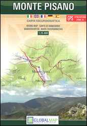
Monte Pisano area between Lucca and Pisa at 1:25,000 on a detailed, contoured, GPS compatible map from Litografia Artistica Cartografica in their Global Map imprint, with special thematic trails and other hiking routes, cycle paths, etc.The map covers the hills between the outskirts of Lucca and Pisa, extending south to the Arno and east to Bientina. Topography is shown by contours at 25m intervals plus colouring for woodlands. Boundaries of local natural parks and nature reserves are marked. Special thematic trails and numerous other waymarked hiking paths are highlighted. Also marked are cycle routes, including the local cycling variant of the Via Francigena. Symbols indicate locations of various places of interest such as visitors centre, archaeological and historical sites, etc. The map has a 1km UTM grid plus latitude and longitude lines at 5’. Map legend includes English.On the reverse are bilingual English/Italian notes about the area and descriptions of five thematic routes. Also provided are Italian language descriptions of the hiking trails.

Related Products:
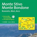 Monte Stivo – Monte Bondone – Rovereto Kompass 687
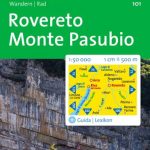 Rovereto – Monte Pasubio Kompass 101
 Monte Baldo North – Bretonico – Malcesine Kompass 691
 Monte Bianco / Mt Blanc – Courmayeur L`Escursionista Editore 1
 Monte Rosa – Ayas – Gressoney – Alagna L`Escursionista Editore 8
 Lake Garda – Lake Idro – Monte Baldo – Verona K+F Outdoor Map 7
 Monte Baldo – Altipiano di Brentonico – Malcesine Kompass 129
 Lake Garda – Monte Baldo Kompass 102
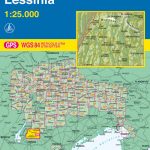 Monte Lessini – Lessinia Tabacco 059
 Parco Regionale Migliarino – S. Rossore – Massaciuccoli Edizioni Multigraphic 503
 Monte Fumaiolo – Monte Comero 18
 Monte Grappa – Basano – Feltre Tabacco 051
 Alto Garda – Ledro – Monte Baldo North Tabacco 061
 Alta Valle del Metauro: Valle del Candigliano, Monte Nerone, Monte Catria
 Cervino – Monte Rosa – Valtourenche – Valle di Champorcher L`Escursionista Editore
 Ordesa and Monte Perdido National Park Editorial Alpina
 Lake Trasimeno – Val d`Orcia – Montepulciano – Monte Amiata Kompass 2463
 Valtournenche – Monte Cervino / Matterhorn – Val d`Ayas West L`Escursionista Editore 7
 Bolzano and Environs Kompass 54
 Maremma – Grosseto – Monte Argentario – Isola di Giglio Kompass 2470
 Arezzo – Casentino – Foreste Casentinesi NP – Monte Falterona Kompass 2459
 Ausseerland – Ennstal – Tauplitz Kompass 68
 Bardonecchia – Monte Thabor – Sauze d`Oulx 25K IGC Map No. 104
 Val Divedro – Alpe Veglia – Bugliaga – Monte Cistella SUPERCEDED
 Monte Rosa – Alagna – Valsesia – Macugnaga – Gressoney IGC 109
 Ordesa and Monte Perdido National Park 2-Map Set Editorial Alpina
 Monte Bianco/Mt. Blanc – Courmayeur – Chamonix – La Thuile 25K IGC Map No. 107
 Ordesa – Monte Perdido National Park Editorial Alpina 2-Map Set
 Monte Baldo ‘“ Malcesine ‘“ Garda Tabacco 063
 Macizo de Monte Perdido – Valle de Ordesa – Pineta Editorial Alpina
 Alpe Veglia – Val Divedro – Bugliaga – Monte Cistella Geo4Map 9
 Monte Rosa – Alagna Valsesia – Rima San Giuseppe – Carcoforo Winter Sports Map
 Calblanque, Monte de las Cenizas and Peรฑa del Aguila Regional Park
 Sierra de Huetor Natural Park Editorial Penibetica SPANISH
 Valsesia – Varallo – Borgosesia – Monte Fenera – Cellio – Postua Geo4Map 2
 Regglberg – Latemar – Val d`Ega / Eggental Kompass 630
 Le Tre Valli Bresciane Kompass 103
 Aeolian (Lipari) Islands Kompass 693
 Gilau Mountains Dimap Hiking Map
Monte Carpegna – Sasso di Simone
Gilau Mountains Dimap Hiking Map
Monte Carpegna – Sasso di Simone