Disclosure : This site contains affiliate links to products. We may receive a commission for purchases made through these links.
Riviera di Ponente: Finale Ligure to Albenga 25K Ed. Multigraphic Map No. 104
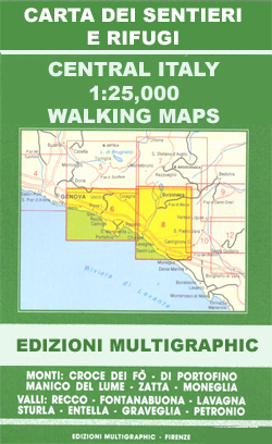
Map No. 104, covering at 1:25,000 the coast of the Italian Riviera from Finale Ligure to Albenga and inland beyond Monte Carmo. The map is part of a series of walking maps from Edizioni Multigraphic covering the Ligurian Alps and the coast, the crest of the Apennines along the border between Tuscany with the neighbouring regions, and parts of Tuscany itself. Cartography is rather old fashioned but provides a lot of local information. Contours are at 25-metre intervals with numerous spot heights. An overprint highlights hiking paths indicating their waymarking, and shows the course of Alta Via dei Monti Liguri long-distance trail. Picturesque towns and villages are also highlighted and symbols indicate other places of interest including mountain refuges. The map has a 1-km grid but does not provide any coordinates. Map legend includes English.


