Disclosure : This site contains affiliate links to products. We may receive a commission for purchases made through these links.
Categories
-
Best Sellers
-
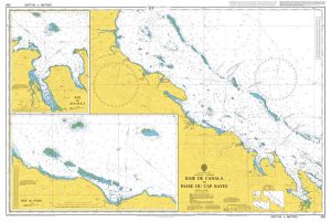
Admiralty Chart 1638 – Plans in Northern Vanuatu
Admiralty standard nautical charts comply with Safety of Life at Sea (SOLAS) regulations and are ideal for professional, commercial and recreational use. Charts within the series Read More » -

Chocolate Box Girls: Fortune Cookie
After the amazing twist at the end of Sweet Honey, the sixth and final book in Cathy Cassidy`s Chocolate Box Girls series follows Jake, the Tanberry Read More » -

Hamburg Regional Map
Hamburg Region on a road map based on the country’s topographic survey at 1:200,000 from the Bundesamt fรผr Kartographie und Geodรคsie, Germany’s federal mapping agency. Coverage Read More » -

Kjรถlur – Langjรถkull – Kerlingrafjรถll
Kjรถlur – Langjรถkull – Kerlingrafjรถll area of Iceland at 1:100,000 in a series of detailed hiking and recreational topographic maps from Mรกl og menning – the Read More » -

On the Marsh: A Year Surrounded by Wildness and Wet
`He does write beautifully, especially of his greatest love – our wild birds … On The Marsh is a delightful read.` Christopher Hart, Daily MailHow the Read More » -

Stories from the Kitchen
Stories from the Kitchen is a mouth-watering smorgasbord of stories with food in the starring role, by a rich variety of authors from Dickens, Chekhov and Read More » -

Stanford`s Eastern Hemisphere Map (1877) – A3 Wall Map, Canvas
The Stanford’s Map of The Eastern Hemisphere is from a fascinating series of reproductions from our Edward Stanford Cartographic Collection archive.The original map from 1877 was Read More » -

The Castles & Palaces Of The Tudors & Stuarts
Illustrated with more than 200 splendid images including beautiful photographs, fine-art paintings, reconstructions and maps. Covers an amazingly wide range of Castles and Stately Houses from Read More » -

Moss Valley and Gwersyllt 1909
Moss Valley and Gwersyllt in 1909 in a fascinating series of reproductions of old Ordnance Survey plans in the Alan Godfrey Editions, ideal for anyone interested Read More » -
Planning Charts for Atlantic Coast of Canada
Canadian Hydrographic Service charts covering large areas of the Atlantic coast of Canada, ideal for planning routes. Read More »
-


