Disclosure : This site contains affiliate links to products. We may receive a commission for purchases made through these links.
3mils.cat: Traverse of Ten 3000m Peaks in the Catalan Pyreness
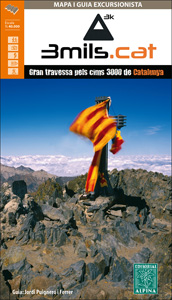
The ‘3mils.cat” route – a 125km / 10 day traverse across 10 over 3000m high peaks in the Catalan Pyrenees – on a contoured and GPS compatible map at 1:40,000 from Editorial Alpina with a booklet providing accommodation details, stage descriptions, etc.The route – from Tuc de Moliรจres o Mulleres (3,010m), just south-east of Pic d’ Aneto, past Pica d’Estats (3,143m) to Pic Rodรณ de Canalbona (3,004m) – is presented on a double-sided, handy size map with contours at 20m intervals enhanced by relief shading, plus colouring for forests, brushwood, and meadows. The course of the main route and its variants is prominently highlighted, and the map also shows other long-distance and local waymarked paths, including the GR11 and the Chariots of Fire (Carros de Foc) circuit. Symbols indicate hotels, gรฎtes, mountain hostels, refuges, huts and campsites, information offices, etc. Road network shows locations of car parks and petrol stations. The map has a UTM grid; map legend includes English.Accompanying 48-page booklet, in Catalan only, has state-by-stage descriptions, route profiles and accommodation details, etc.

Related Products:
 Menorca – Camรญ de Cavalls – GR223 Editorial Alpina CATALAN
 Pass`Aran Circuit: Couserans – Val d`Aran
 Sierra Nevada – the Traverse at 3000m Editorial Piolet
 Peaks of the Balkans Long-Distance Hiking Trail: Albania ‘“ Kosovo ‘“ Montenegro
 Tour of the Canigรณ Hiking Circuit
 Massif Central Grand Traverse (700km)
 Guadarrama High Route
 Cavalls del Vent – Cadi-Moixero Natural Park Hiking Circuit Editorial Alpina
 La Alta Ruta de los Perdidos – Monte Perdido – Vignemale Editorial Alpina Hiking Circuit Map
 Camino Catalan – The Tranquil Route towards Santiago de Compostela
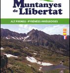 Muntanyes de Llibertat Hiking Circuit
 Cervino – Monte Rosa – Valtourenche – Valle di Champorcher L`Escursionista Editore
 Catalan-English/ English-Catalan Practical Dictionary
 La Senda de Camille Editorial Alpina
 Pica d`Estats – Mont-roig Editorial Alpina
 Garrotxa – Zona Volcanica Editorial Alpina
 Ruta dels Estanys Amagats
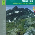
 Pica d`Estats – Mont-roig – Vall Ferrera – Valls de Cardos Editorial Alpina
 The Hermitage (Ruta de l`Ermitร ) Hiking Circuit
 France: Chamina Maps of Long-distance Mountain Bike Routes
 The Hidden Lakes (Ruta dels Estanys Amagats) Hiking Circuit
 Alt Pirineu Natural Park Editorial Alpina
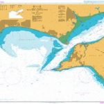
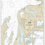 NOAA Chart 14913 – Grand Traverse Bay to Little Traverse Bay – Harbor Springs – Petoskey – Elk Rapids – Suttons Bay – Northport – Traverse City
 Ibiza – Formentera Editorial Alpina
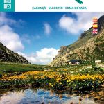 Travessa 3 Refugis – Caranรงร – Ulldeter – Coma de Vaca Editorial Alpina
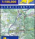 Spain: 100K Catalan Topographic Survey
 Catalan Dictionary and Phrasebook
Carros de Foc Hiking Circuit Editorial Alpina
Catalan Dictionary and Phrasebook
Carros de Foc Hiking Circuit Editorial Alpina
 Menorca – Camรญ de Cavalls – GR223 Editorial Alpina ENGLISH
 Muntanyes Mร giques / Magical Mountains Hiking Trail
 Ripollรจs Editorial Alpina
 Spain: 50K Catalan Topographic Survey
 Vall de Lord – Port del Comte Editorial Alpina
 Grande Traversรฉe de l’Hรฉrault a VTT: Montpellier ‘“ La Salvetat/Minervois
 Zillertal Alps: Trekking and Peaks in the Austrian Tyrol and Italian South Tyrol
 Tyrol Mountain Bike Trail (1000km) Bikeline Atlas
 Selvaggio Blu Hiking Trail – Sardinia
 Andorra Trail Running 40K Ed. Alpina Map
 Grande Traversรฉe Ariรจge-Pyrรฉnรฉes ร VTT: Ax-les-Thermes ‘“ Lacave (223km)
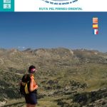
 The GR11 Trail: The Traverse of the Spanish Pyrenees – La Senda Pirenaica