Disclosure : This site contains affiliate links to products. We may receive a commission for purchases made through these links.
Andalucรญa West: Cรณrdoba – Seville – Mรกlaga 500K CNIG Regional Map No. 11
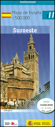
The western part of Andalucรญa, from Cรณrdoba to the Straits of Gibraltar and extending along the Mediterranean coast eastwards beyond the Costa del Sol and Mรกlaga to Nerja, at 1:500,000 in a series of regional road maps from the country’s civilian survey organization IGN-CNIG (Instituto Geogrรกfico Nacional – Centro Nacional de Informaciรณn Geogrรกfica), vividly presenting the topography by altitude colouring, boundaries of national/natural parks, etc.Road network is graded and coloured into six types; road numbers are given only on main national roads and no driving distanced are marked. Railway lines are shown with stations and local airports are marked. Icons prominently indicate UNESCO World Heritage sites and state-run parador accommodations. The maps also show administrative boundaries and all place names and other information (roads, railways, topographic features) are presented classified according to its official status. Topography (shown only within Spain’s borders) is indicated by satellite imagery enhanced by altitude colouring, with spot heights, names of mountain ranges, boundaries of national/natural parks, etc. The maps have latitude and longitude lines at 30’ intervals. Map legend is in Spanish only. The series was first published in 2014.To see other titles in this series please click on the series link.

Related Products:
 Extremadura: Badajoz – Toledo – Cรณrdoba 500K CNIG Regional Map No. 8
 Andalucรญa East: Granada – Almerรญa – Murcia 500K CNIG Regional Map No. 12
 Pyrenees West – Zaragoza – Santander – Burgos 500K CNIG Regional Map No. 3
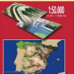
 Spain: CNIG 500K Regional Road Maps
 Galicia: Santiago de Compostela – Leรณn 500K CNIG Regional Map No.1
 Madrid – Toledo – Zagaroza 500K CNIG Regional Map No. 6
 Pyrenees East – Barcelona – Costa Brava 500K CNIG Regional Map No. 4
 Barcelona – Zaragoza – Castellรณn de la Plana 500K CNIG Regional Map No. 7
 Valencia – Alicante – Murcia 500K CNIG Regional Map No. 9
 Canary Islands West: Gran Canaria, Tenerife, La Palma, Gomera, Hierro 500K CNIG Regional Map No. 14
 Salamanca – Sierra de Gredos – Madrid 500K CNIG Regional Map No. 5
 Straits of Gibraltar – Costa del Sol – Almerรญa 500K CNIG Regional Map No. 13
 Balearic Islands 500K CNIG Regional Map No. 10
 Canary Islands East: Gran Canaria, Fuerteventura, Lanzarote 500K CNIG Regional Map No.
 Spain North 500K CNIG 2
 Cรณrdoba Province 200K CNIG Map No. 16
 Mรกlaga Province 200K CNIG Map No. 31
 Mรกlaga CNIG Topo 1053
 Seville Province 200K CNIG Map No. 40
 USA: Reise Know-How Regional Touring Maps
 Cantabria Autonomous Community CNIG Physical Road Map
 Extremadura Auotomous Community CNIG Physical Road Map
 Central Asia: 500K Regional Topographic Maps
 Norway: Nordeca 500K Regional Road Maps
Murcia Autonomous Region 200K CNIG Physical Road Map
Castilla-la-Mancha Autonomous Region 400K CNIG Physical Road Map
Norway: Nordeca 500K Regional Road Maps
Murcia Autonomous Region 200K CNIG Physical Road Map
Castilla-la-Mancha Autonomous Region 400K CNIG Physical Road Map
 Castilla y Leon Autonomous Community CNIG Physical Road Map
Castilla-La Mancha Autonomous Community CNIG Physical Road Map
Castilla y Leon Autonomous Community CNIG Physical Road Map
Castilla-La Mancha Autonomous Community CNIG Physical Road Map
 Poland South West Michelin Regional 557
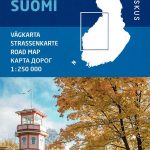 Finland West Karttakeskus Road Map
 Wales – South West England – Midlands Michelin Regional 503
Spain: CNIG Road Maps of Autonomous Administrative Regions
Wales – South West England – Midlands Michelin Regional 503
Spain: CNIG Road Maps of Autonomous Administrative Regions
 China: GiziMap Regional Maps
 Bavaria North – Saxony – Thuringia K+F Regional Road Map
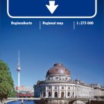 Berlin – Brandenburg – Saxony-Anhalt K+F Regional Road Map
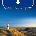 North Sea Coast – Bremen – Hamburg K+F Regional Road Map
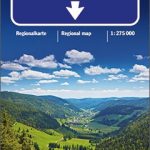 Baden-Wรผrttemberg – Black Forest K+F Regional Map
 Baltic Sea Coast – Hamburg – Berlin K+F Regional Map
 North Rhine-Westphalia – Cologne – Ruhr Area K+F Regional Road Map
 Alaska Reise Know-How