Disclosure : This site contains affiliate links to products. We may receive a commission for purchases made through these links.
Tatras Central: Zakopane – Kasprowy Wierch (Tatry Reglowe)
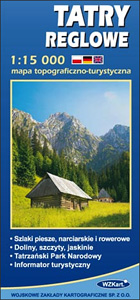
The central part of the Tatra Mountains on an exceptionally detailed, contoured and GPS compatible map at 1:15,000 from WZKart – Poland’s Army Cartographic Service. Coverage in the northern part of the map starts at Gubalwka just north of Zakopane, extending along the peaks from Smerczynski Wierch to Swinica, so includes some of the most popular hiking and ski trails in the Polish Tatras.Contours are at 10m intervals, with additional graphics to show exposed rocks and individual outcrops. Colouring and/or graphics indicate different types of vegetation. An overprint highlights hiking trails, indicating their waymarking colours, as well as local ski and cycling routes. Also marked are directions of possible avalanches and recommended routes in cases of danger. Mountain passes are annotated with the likely seasonal openings. Road network shows locations of public transport buses and private minibuses or horse drawn carts, plus roads closed to motorized traffic. An extensive range of symbols indicate various accommodation options (hotels, campsites, shelters, etc), restaurants and bars, medical facilities, viewpoints, caves open to the public. etc. The map has latitude and longitude lines at 1’ intervals. Map legend includes English. Extensive text on the reverse is in Polish only.To see other titles in this series please click on the series link.

Related Products:
 Tatras Western: Koscielisko and the Western Valleys (Tatry Zachodnie)
 Western Tatras – Polish and Slovak
 High Tatras – Polish and Slovak
 Italy Central Michelin Regional 563
 The High Tatras: Slovakia and Poland – Including the Western Tatras and White Tatras
 High Tatras Kompass 2130
 Quito & Central Ecuador ITMB
 Low Tatras / Nรญzke Tatry – Chopok – Kralova hola 475
 Tatras High and Western – Belaer Kompass 2100
 Dalmatia – Croatia Coast Central and South
 Central Lycia – Kas and neighbouring Areas
 Aviemore & Central Cairngorms AA Walker`s Map 28
 West & Central Brecon Beacons AA Walker`s Map 18
 Sardinia Central 4-Map Set Kompass 2498
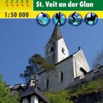 Central Carinthia – Gurktal Alps – Friesach – Feldkirchen – St. Veit an der Glan F&B WK231
 Portugal Central Michelin Regional 592
 Central Lewis & Stornoway – Eye Peninsula & Callanish OS Explorer Map 459 (paper)
 Tatras Mountains – Poland & Slovakia
 Norfolk Coast Central – Wells-next-the-Sea & Fakenham OS Explorer Map 251 (paper)
 Central Pyrenees terraQuest Trekking Map
 Sobrarbe Central – Ainsa – Boltana Editorial Alpina
 Central Lewis & Stornoway – Eye Peninsula & Callanish OS Explorer Active Map 459 (waterproof)
 Norfolk Coast Central – Wells-next-the-Sea & Fakenham OS Explorer Active Map 251 (waterproof)
 Mallorca F&B 2-Map Set
 Market Weighton & Yorkshire Wolds Central – Pocklington OS Explorer Map 294 (paper)
 Market Weighton & Yorkshire Wolds Central – Pocklington OS Explorer Active Map 294 (waterproof)
 Shetland: Mainland Central – Lerwick, Papa Stour & Foula OS Explorer Map 467 (paper)
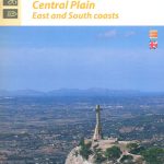 Mallorca Central Plain – East and South Coasts Editorial Alpina
 Shetland: Mainland Central – Lerwick, Papa Stour & Foula OS Explorer Active Map 467 (waterproof)
 Central Norrland Norstedts Regional Map 5
 Brecon Beacons Western & Central OS Explorer Map OL12 (paper)
 Brecon Beacons Western & Central OS Explorer Active Map OL12 (waterproof)
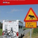
 Central Europe F&B Compact Road Atlas
 Mallorca – Tramuntana Central Editorial Alpina
 Central Moselle Valley – Trier to Zell K+F Outdoor Map 22
 North Rhine-Westphalia Central/South – Hesse Northwest 2-Map Cycling Set Kompass 3706
 Italy: IGA 25K Hiking Maps of Central Italy
 Mallorca F&B
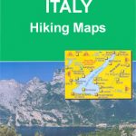
 Italy: IGA 50K Hiking Maps of Central Italy