Disclosure : This site contains affiliate links to products. We may receive a commission for purchases made through these links.
Mumbai (Bombay) Street Atlas
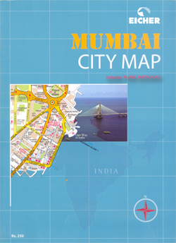
Mumbai Street Atlas (publisher title Mumbai City Map) in a paperback 163-page street atlas at 1:12,500 with very well designed, clear cartography, detail including house numbers, plus an extensive index which also lists of various services and facilities. A separate fold-out map overprinted with page layout is provided for route planning.Coverage extends north to Vasai Creek and includes Thane Bhayandar. The atlas has very well designed, clear cartography, with colours indicating residential and industrial areas, slums (zopad patti), shopping streets and centres, parks and gardens, and wooded areas. Names of colonies and villages are shown with, where appropriate, designation of their zones and house numbers. Street information includes dual carriageways, flyovers and underpasses, one way streets, traffic lights and pedestrian subways. A very vide range of symbols indicate various facilities and places of interest, including banks and ATM counters, taxi stands, fuel supplies, monuments and museums, restaurants and hotels, places of worship, police stations, post offices, electricity/water/sewer complaint offices, etc. Extensive index includes separate lists of various public offices and services including foreign missions, hotels, restaurants, shopping centres, etc.The central part of the city is shown enlarged in greater detail. Also provided is a separate route planning map overprinted with a grid showing the numbering of the atlas pages.

Related Products:
 Chennai / Madras Street Atlas
 Navi Mumbai Street Atlas
 Skopje Street Atlas
 Delhi Street Atlas
 Cape Town – Western Cape Towns Map Studio Street Atlas
 Mumbai / Bombay – India West Coast ITMB
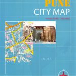 Pune City Street Atlas
 Surrey A-Z Street Atlas
 Nottinghamshire A-Z County Street Atlas
 Zurich Street Atlas
 Oslo Cappelen Street Atlas
 Helsinki Region Street Atlas
 West Yorkshire – Leeds – Bradford A-Z Street Atlas
 West Sussex A-Z Street Atlas
 West Midlands – Birmingham – Coventry – Wolverhampton A-Z Street Atlas
 Manchester A-Z Big Street Atlas SPIRAL-BOUND
 Bristol – Bath A-Z Street Atlas
 Gloucestershire Philip`s Street Atlas
 Aberdeen A-Z Street Atlas
 Bolton – Bury A-Z Street Atlas
 Barcelona: Greater Barcenona Telstar Street Atlas
 Kolkata / Calcutta Street Atlas
 Cornwall Philip`s Street Atlas
 Derbyshire Philip`s Street Atlas
 Devon Philip`s Street Atlas
 Bournemouth – Poole – Christchurch A-Z Street Atlas
 Isle of Wight A-Z Street Atlas
 Dartford – Gravesend A-Z Street Atlas
 Blackburn – Accrington – Burnley A-Z Street Atlas
 Weymouth – Dorchester A-Z Street Atlas
 Hastings – Bexhill – St. Leonards – Rye A-Z Street Atlas
 Birmingham – Dudley – Solihull – Walsall – Wolverhampton A-Z Big Street Atlas
 Surrey Philip`s Street Atlas
Southport – Formby – Ormskirk – Skelmersdale A-Z Street Atlas
Surrey Philip`s Street Atlas
Southport – Formby – Ormskirk – Skelmersdale A-Z Street Atlas
 Norfolk Philip`s Street Atlas
 Glasgow – Hamilton – Motherwell – Paisley A-Z Street Atlas
 Macclesfield – Congleton – Knutsford – Wilmslow A-Z Street Atlas
 Wirral – Birkenhead – Ellesmere Port – Wallasey A-Z Street Atlas
 Tyne & Wear – Newcastle upon Tyne – Sunderland A-Z Street Atlas
 Basingstoke- Andover – Overton – Whitchurch A-Z Street Atlas