Disclosure : This site contains affiliate links to products. We may receive a commission for purchases made through these links.
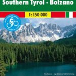
South Tyrol Wine Route – Merano – Bolzano 2-Map Set Kompass 078

Related Products:
 South Tyrol Kompass Hiking & Recreational Kompass Ring-binder Atlas No. 2703: Bormio – Merano – Bolzano – Cortina d`Ampezzo
 La Strada del Vino / South Tyrol Wine Route Kompass 685
 South Tyrol Wine Route – Unterland / Bassa Atesina Kompass 074
 Bolzano Vignetei e Dolomiti / Southern South Tyrol Kompass 74
 South Tyrol – Bolzano F&B Top 10 Tips
 Bolzano – Caldaro – Wine Route – Eggental – Neumarkt – Cavalese K+F Outdoor Map 3
 Texelgruppe NP – Merano High Route Kompass 043
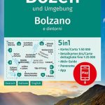
 Bolzano – Merano
 South Tyrol – Dolomites 4-Map Set Kompass 699
 South Tyrol Cycle Route Bikeline Map-Guide Compact
 Merano and Environs – Texel Group – Sarntal – Bolzano K+F Outdoor Map 2
 Vorarlberg – Tyrol – Upper Bavaria – South Tyrol 200K Marco Polo Zoom Map
 Merano Kompass 053
 Zillertal Alps: Trekking and Peaks in the Austrian Tyrol and Italian South Tyrol
 Merano and Surroundings Kompass 53
Upper Bavaria – Tyrol – South Tyrol Motorcycle Map
Merano and Surroundings Kompass 53
Upper Bavaria – Tyrol – South Tyrol Motorcycle Map
 Bolzano and Environs Kompass 154
 Bolzano and Environs Kompass 54
South Tyrol Cycling Map
Bolzano and Environs Kompass 54
South Tyrol Cycling Map
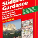 South Tyrol – Lake Garda
 South Tyrol – Trentino – Lake Garda – Veneto F&B
 South Tyrol Cycle Region Bikeline Map-Guide
 South Tyrol – Dolomites Tabacco Road and Panorama Map
 South Tyrol – Trentino – Lake Garda ADAC Holiday Map
 Lake Garda – South Tyrol High 5 Edition Adventure Map
 South Tyrol – Lake Garda – Venice 3in1 Flash Guide
Munich – South Tyrol – Upper Bavaria 3in1 Flash Guide
South Tyrol – Lake Garda – Venice 3in1 Flash Guide
Munich – South Tyrol – Upper Bavaria 3in1 Flash Guide
 Austria – Liechtenstein – South Tyrol Marco Polo Road Atlas
Baden Wine Country Cycling Route Bikeline Map-Guide
Austria – Liechtenstein – South Tyrol Marco Polo Road Atlas
Baden Wine Country Cycling Route Bikeline Map-Guide
 Wรผrzburg – Maindreieck – Schweinfurt – Franconian Wine Country Kompass 166
 Blue Guide Trentino & the South Tyrol
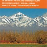 Mendoza, Argentina – Wine Route
 South Tyrol – Trentino – Lake Garda Cycling Map 28
 Austria – Bavavia – South Tyrol Freytag & Berndt Ski-Atlas
Italy: Tabacco 25K Maps of the Regional Parks in South Tyrol
Austria – Bavavia – South Tyrol Freytag & Berndt Ski-Atlas
Italy: Tabacco 25K Maps of the Regional Parks in South Tyrol
 Mountain Route Odenwald-Neckar Valley 2-Map Set Kompass 827
 South America De Long Wine Map
 South Africa De Long Wine Map
 South Africa De Long Wine Wall Map