Disclosure : This site contains affiliate links to products. We may receive a commission for purchases made through these links.
Istria Kompass 238
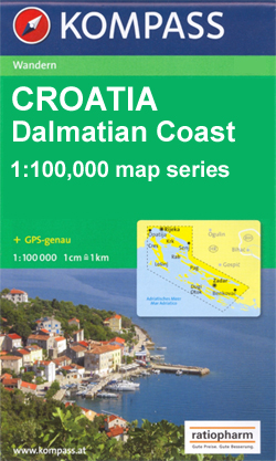
Istria at 1:75,000 on a double-sided, waterproof and tear-resistant, detailed contoured map from Kompass, with hiking and cycling routes, street plans of 10 main towns, plus tourist information. Coverage extends north beyond the Croatian border to include Trieste and the coast of Slovenia. Contours at 50m intervals and spot heights present the terrain. An overprint highlights hiking trails, including the E6 trans-European long-distance route, indicating steep, partially waymarked sections. Cycle and mountain bike routes are also marked. Road network includes farm roads and forest tracks. Railways are shown with stations and ferry routes are marked. Symbols indicate various tourist facilities and places of interest, including campsites and youth hostels, nudist beaches, diving and surfing sites, sport and recreational facilities, cultural monuments, etc. The map has no geographical coordinates. Map legend includes English.The map also provides street plan of central areas of Pula, Rovinj, Opatija, Vrsar, Umag, Novigrad, Porec, Piran and Portoroลพ, plus Trieste. A separate booklet, in German only, provides a brief guide to the island, contact details, etc – the booklet is not available in an English edition.PLEASE NOTE: the Dalmatian coast of Croatia south of Opatia is covered by Kompass on three maps at 1:100,000 and with markedly different cartography ‘“ please click on the series link to see the 100K titles and the cartography sample for these maps.

Related Products:
 Slovenia: Kompass 75K Hiking and Cycling Maps
 Bornholm Kompass 236
 Alto Garda – Ledro – Valle del Sacra Kompass 096
 Regglberg – Latemar – Val d`Ega / Eggental Kompass 630
 Gran Canaria Kompass 237
 Lanzarote Kompass 241
 Lake Garda South – Bardolino – Lazise – Desenzano del Garda Kompass 695
 Monte Baldo North – Bretonico – Malcesine Kompass 691
 Alto Garda and Ledro – Riva del Garda – Malcesine – Torbole – Limone sul Garda Kompass 690
 Madeira Kompass 234
 Tenerife Kompass 233
Val d`Ultimo / Ultental Kompass 052
Tenerife Kompass 233
Val d`Ultimo / Ultental Kompass 052
 La Palma Kompass 232
 Cortina d`Ampezzo – Dolomiti Ampezzane Kompass 617
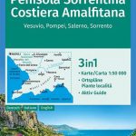 Sorrento Peninsula – Amalfi Coast – Vesuvius – Pompeii – Salerno – Sorrento Kompass 682
 Lake Garda: Trento – Brescia – Verona 35K Kompass Hiking Atlas No. 2752
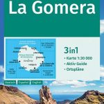 La Gomera Kompass 231
 Maribor – Pomurje – Drava Valley Kompass 2802
 Val di Funes / Villnรถsstal Kompass 627
Fuerteventura Kompass 240
Val di Funes / Villnรถsstal Kompass 627
Fuerteventura Kompass 240
 Catinaccio / Rosengarten – Latemar Kompass 629
 Ortles / Ortler – Cevedale Kompass 077
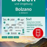 Bolzano and Environs Kompass 54
Val Pusteria / Pustertal 3-Map Set Kompass 671
Bolzano and Environs Kompass 54
Val Pusteria / Pustertal 3-Map Set Kompass 671
 Ausseerland – Ennstal – Tauplitz Kompass 68
 Val di Fiemme / Fleimstal – Catena dei Lagorai Kompass 618
 Monti di Fundres / Pfunderer Berge Kompass 081
Alpe di Siusi / Seiser Alpen Kompass 067
Dolomiti di Brenta Kompass 073
Monti di Fundres / Pfunderer Berge Kompass 081
Alpe di Siusi / Seiser Alpen Kompass 067
Dolomiti di Brenta Kompass 073
 Baltic Sea Coast – Wismar to Usedom 3-Map Set Kompass 739
 Silandro / Schlanders and Surroundings – Val Martello / Martelltal Kompass 069
 Elba Kompass 2468
Val Venosta / Vinschgau 3-Map Set Kompass 670
Elba Kompass 2468
Val Venosta / Vinschgau 3-Map Set Kompass 670
 Brunico / Bruneck – Plan de Corones / Kronplatz Kompass 045
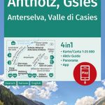 Anterselva / Antholz – Valle di Casies / Gsies Kompass 057
 Ibiza – Formentera Kompass 239
 Dolomiti di Brenta – Madonna di Campiglio – Pinzolo – Andalo Kompass 688
Adamello-Brenta Geopark NP Kompass 070
Val Badia / Gedertal Kompass 51
Dolomiti di Brenta – Madonna di Campiglio – Pinzolo – Andalo Kompass 688
Adamello-Brenta Geopark NP Kompass 070
Val Badia / Gedertal Kompass 51
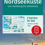 North Sea Coast – Hamburg to Denmark 2-Map Set Kompass 723